Outstrays Managed Realignment Scheme
Environmental expertise to support the creation of new compensatory habitats for wildlife as part of a £18m managed realignment scheme on the north bank of the Humber Estuary.
Outstrays Managed Realignment Scheme
Environmental expertise to support the creation of new compensatory habitats for wildlife as part of a £18m managed realignment scheme on the north bank of the Humber Estuary.
Outstrays Managed Realignment Scheme
Environmental expertise to support the creation of new compensatory habitats for wildlife as part of a £18m managed realignment scheme on the north bank of the Humber Estuary.
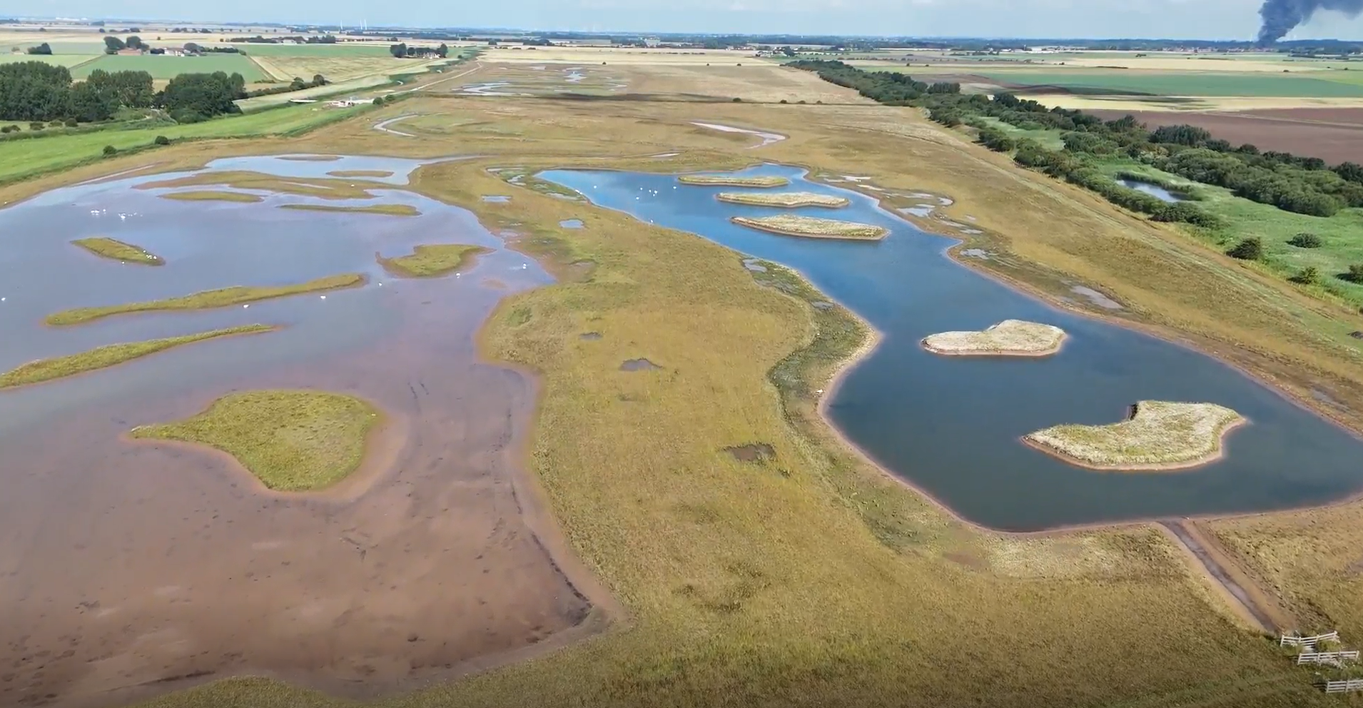
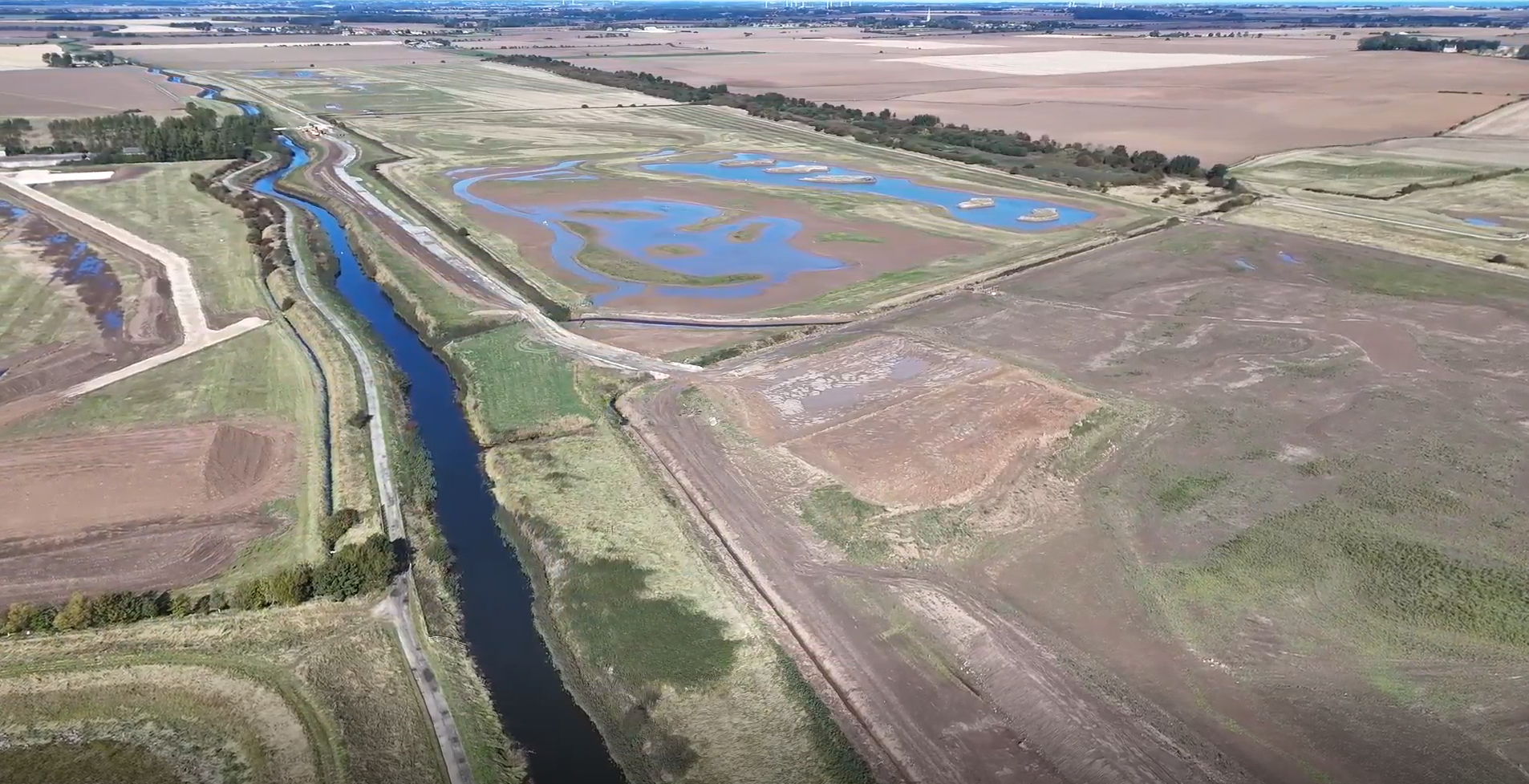
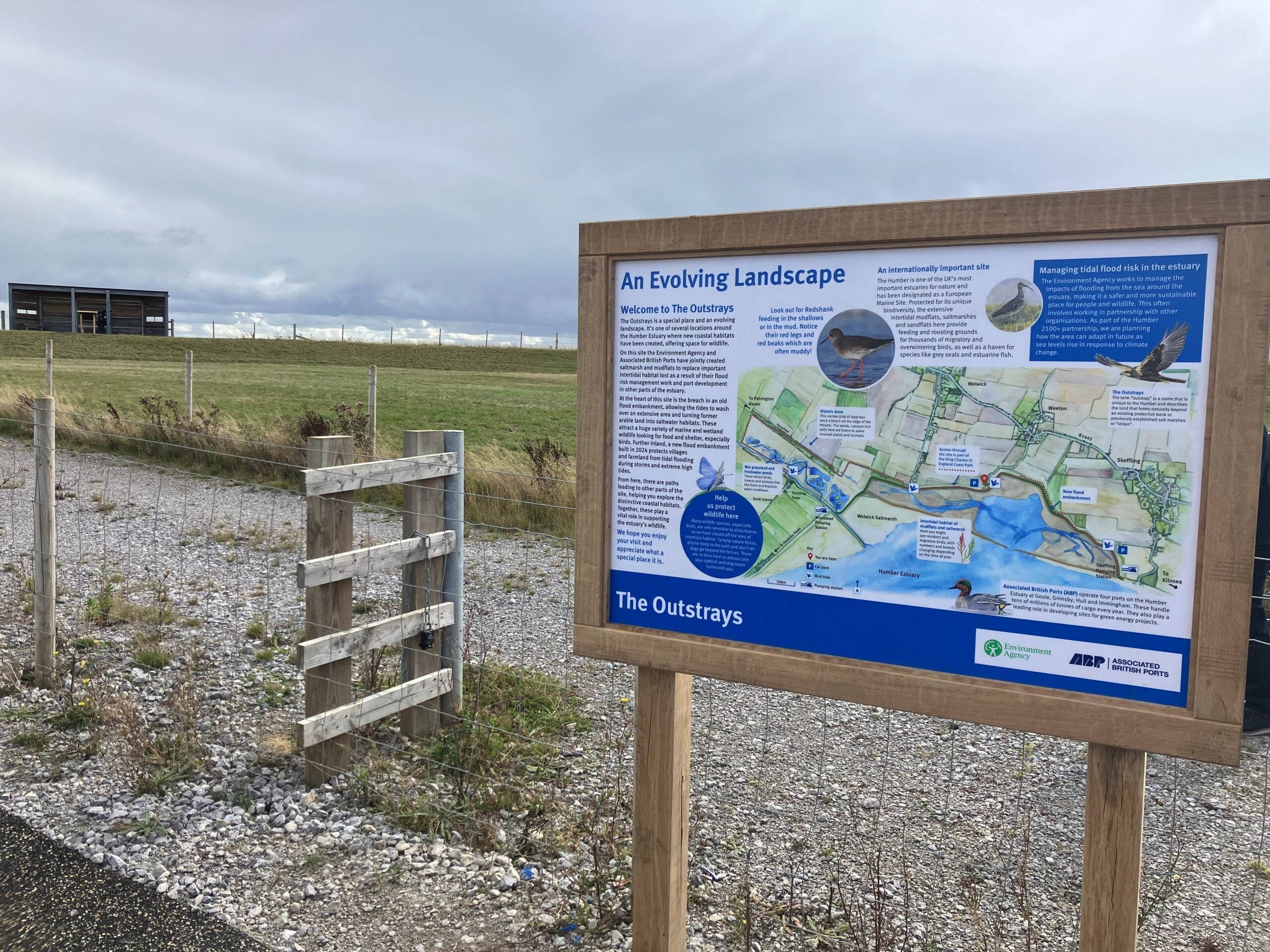
Located between Patrington Haven and Skeffling, the Outstrays Managed Realignment Scheme brought together a range of project partners and stakeholders to support the creation of 250ha of rare wetland habitat, while facilitating future flood risk management for communities, industry and infrastructure around the Humber Estuary.
- Client Environment Agency
- Location Skeffling, Humber Estuary
- Project partners and stakeholders JBA Bentley, ABP, Natural England, Yorkshire Wildlife Trust, RSPB, Spurn Bird Observatory, East Riding of Yorkshire Council, local parish councils and naturalist groups
- Services
Delivering improved flood resilience and large-scale habitat creation through engineering and environmental collaboration
The Humber Estuary is recognised as one of the most important estuaries for wildlife in Europe and is protected under national nature conservation legislation. As part of the regulations, any habitat lost through human activity must be replaced as compensatory habitat. The Outstrays Managed Realignment Scheme seeks to rebalance the impact of rising sea levels and new flood risk management around the Humber by creating new, ecologically valuable habitats on former arable land.
What is managed realignment?
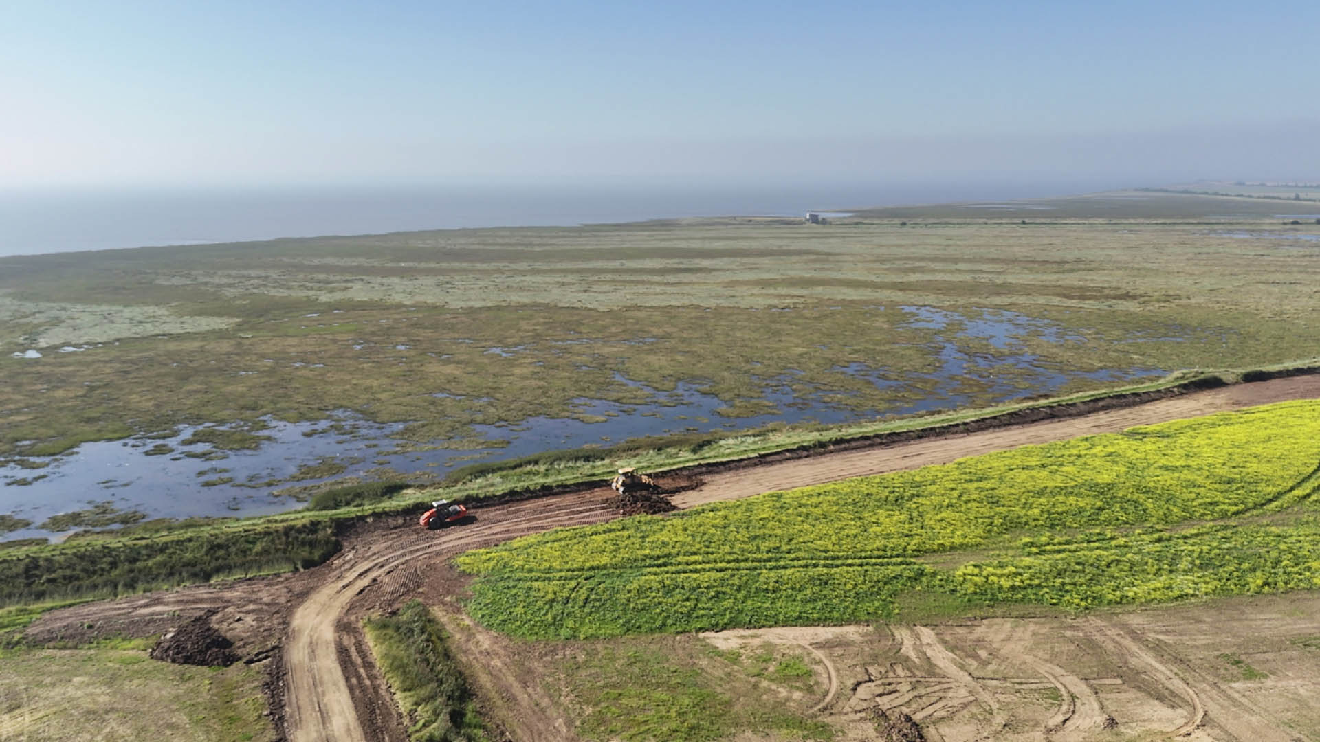
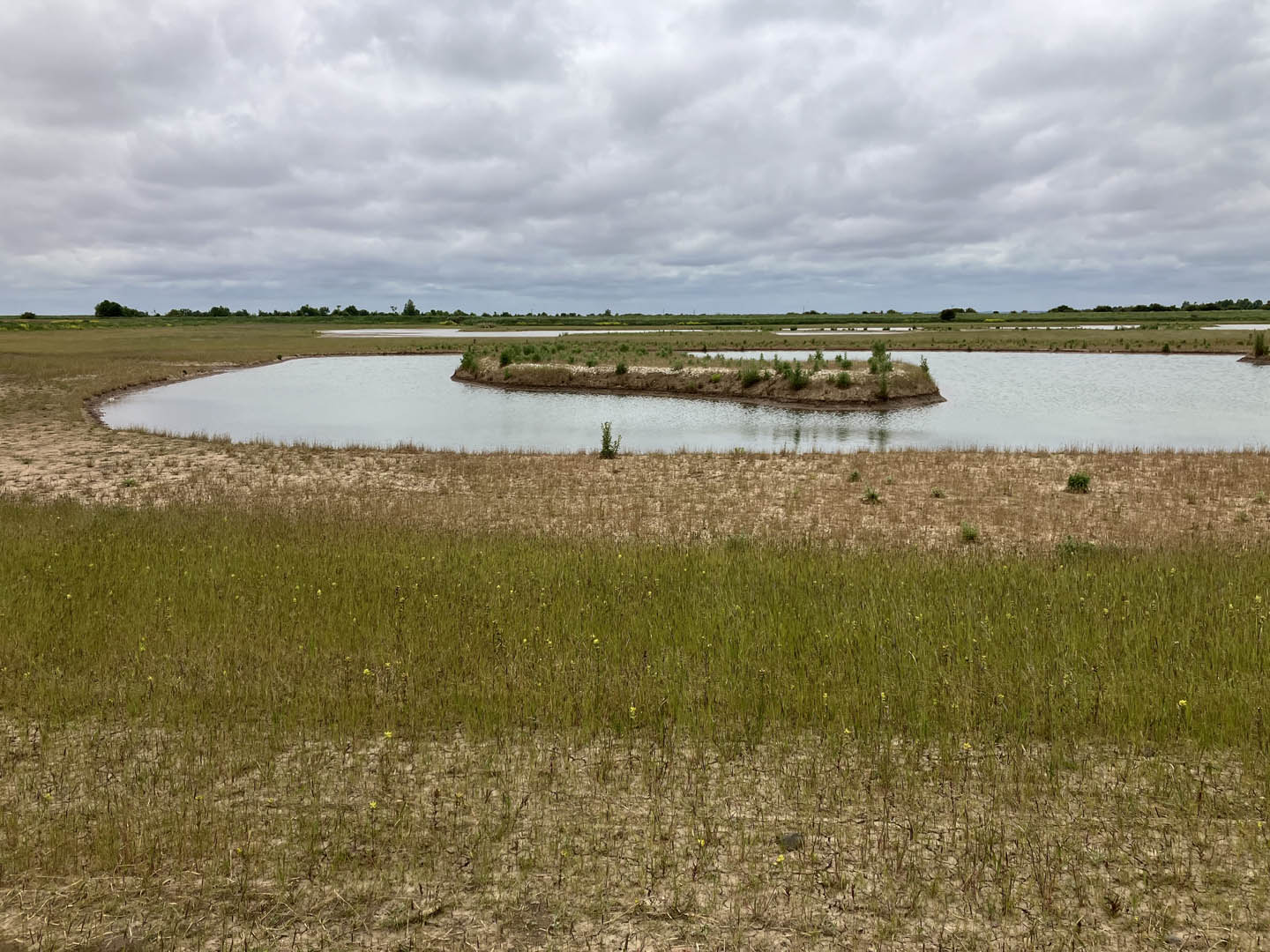
Managed realignment is a sustainable coastal management strategy. In this project, the managed realignment approach consisted of three phases. The first phase was to construct an area of freshwater habitat and higher roosting ground adjacent to the proposed new intertidal habitat. The second phase involved constructing a new flood embankment further inland from an existing one, and creating a variety of habitats, including tidal channels in the area between the old and new embankments. The final phase was to breach the old flood embankment, allowing a controlled flow of tidal water into the area to enable the transition of the arable land to mudflat and saltmarsh.
How were we involved?
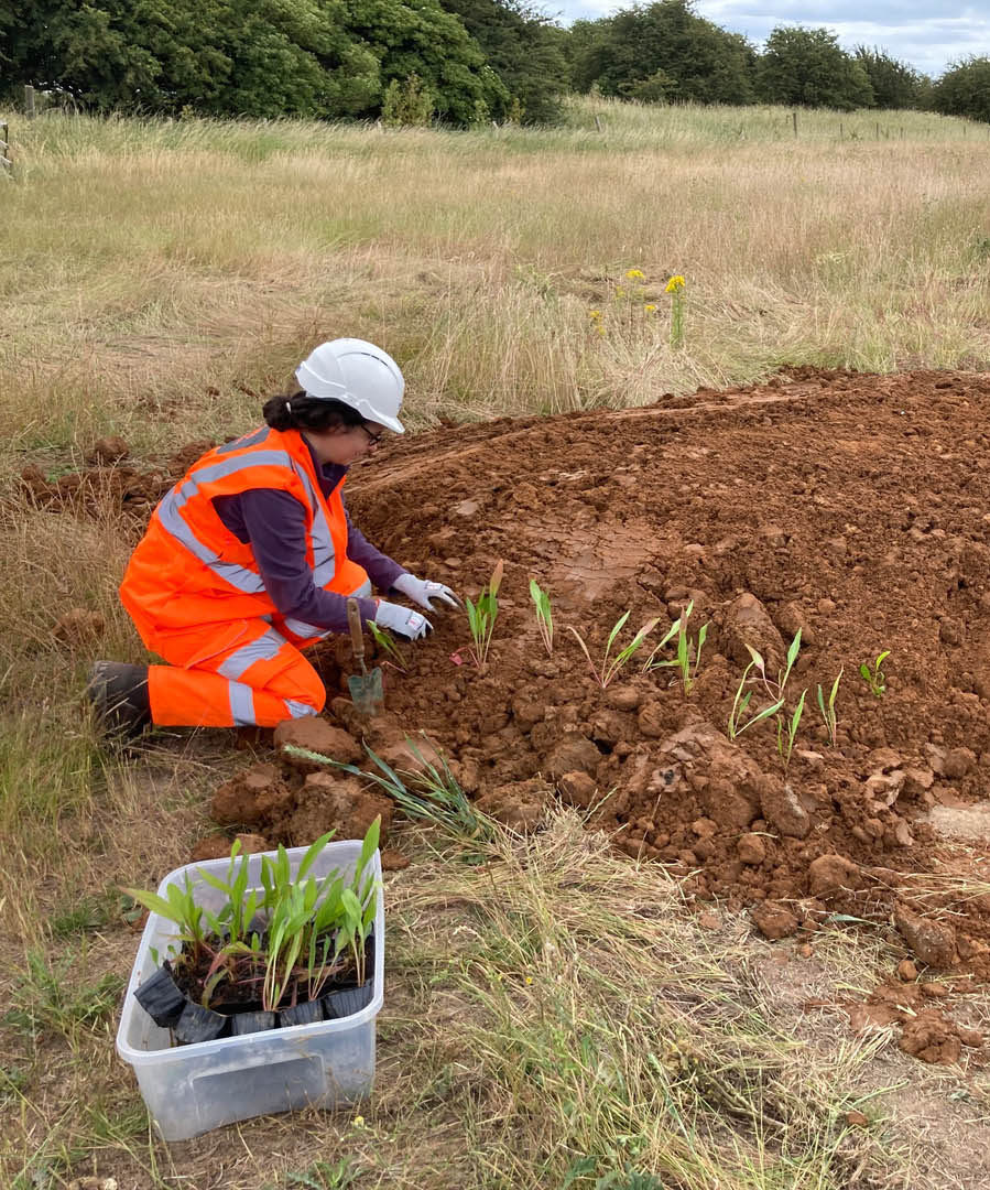
Led by our colleagues at JBA Bentley, this large-scale habitat creation scheme saw close collaboration between our engineering and environmental teams. Due to the highly ecologically sensitive nature of the area, we initially supported the design phase by conducting a range of ecological surveys. We created a record of the site's existing habitats and species, and were able to make recommendations and propose mitigation strategies to limit the ecological impact of the work.
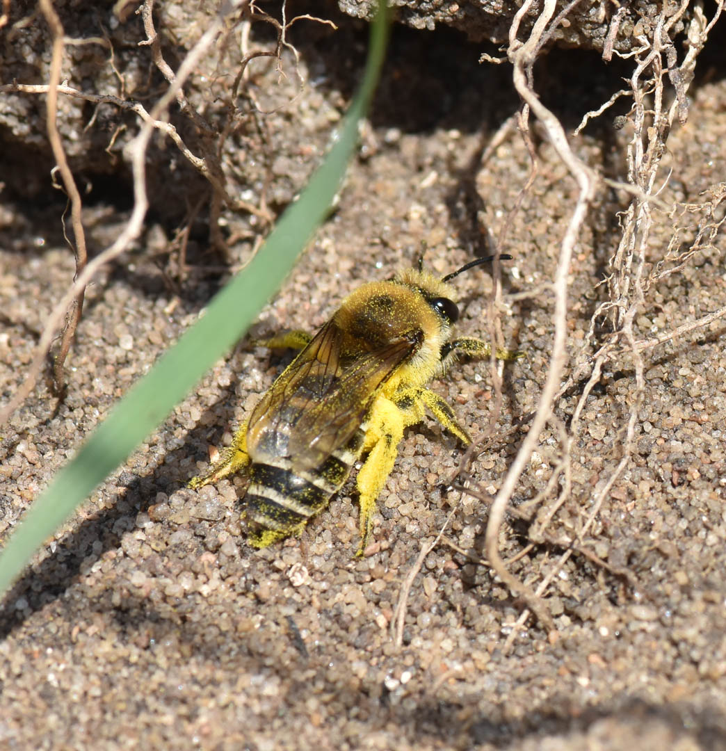
A key element of our involvement was developing integrated working strategies to ensure the site's ecological constraints were managed effectively. We worked collaboratively to create exclusion zones and restricted 'working windows' (from March to October each year), and adopted species-specific mitigation strategies for Marsh Harriers, Water Voles, Badgers and reptiles, among others. One such mitigation strategy involved an innovative technique for relocating Sea Aster Mining Bees. The translocation involved using sand-filled boxes as artificial nesting sites, enabling the bees to be moved into new habitats before they emerged from hibernation.
Creating the conditions for wildlife to thrive
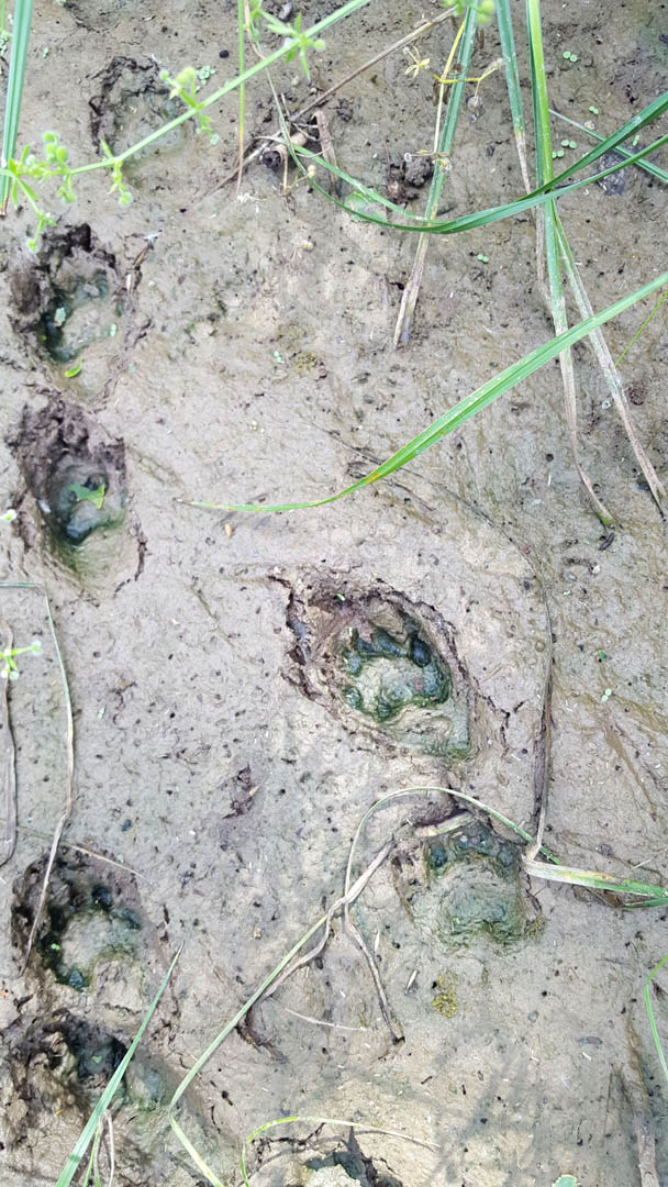
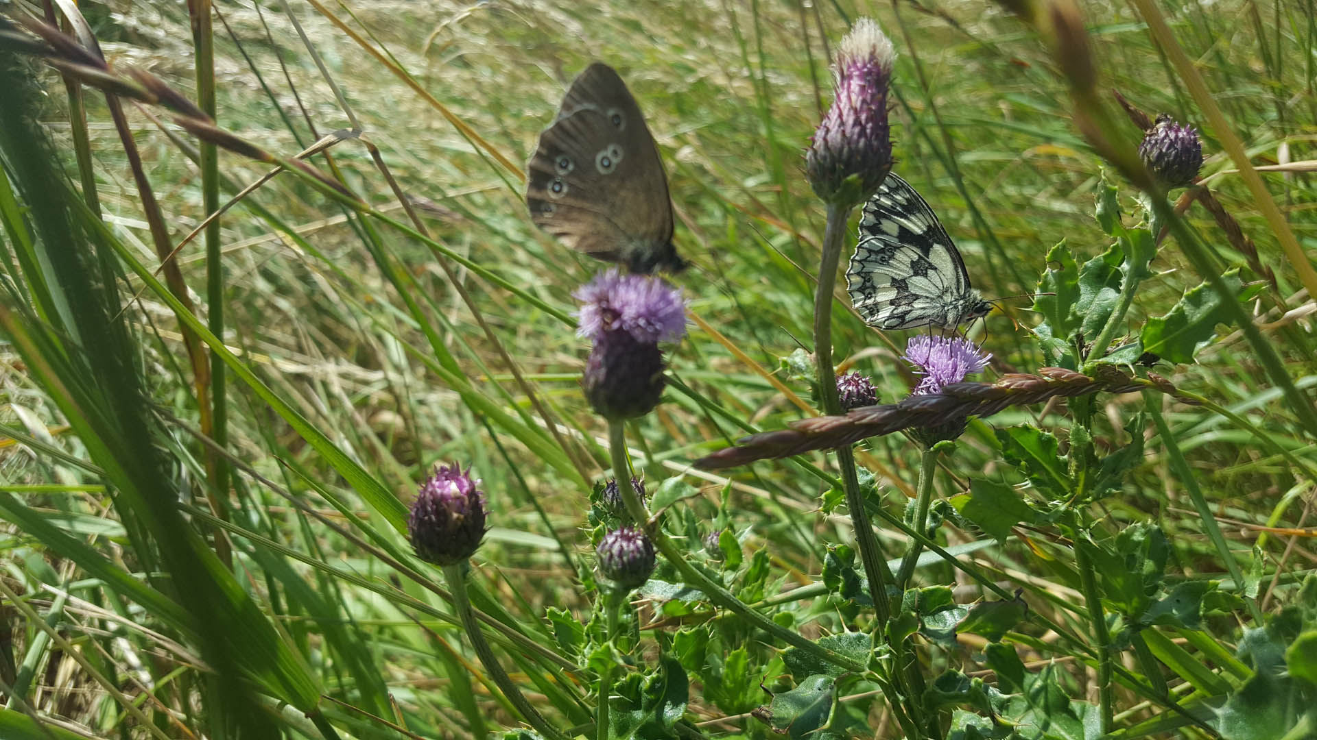
The Outstrays Managed Realignment Scheme has led to the creation of 175ha of intertidal habitat (including mudflats and saltmarsh) and 87ha of freshwater wet grassland, providing a home for a range of species, including rare and endangered birds. To provide further benefits to wildlife, more than 11,600 native shrubs and trees have been planted around the boundaries of the intertidal areas, as well as 700m of species-rich hedge - going well beyond the required planting target. Additional habitats have also been created through the installation of Barn Owl boxes, the formation of an artificial Badger sett and the development of innovative nesting banks for Sea Aster Mining Bees.
Following the planned breach in summer 2024, initial monitoring has already highlighted the presence of target species in the newly created habitats, including more than 130 species of birds. Read more about the scheme's early environmental successes here.
A 20-year monitoring plan has been established to survey the changes at the Outstrays site. As the site continues to evolve, this will provide valuable evidence of the long-term benefits of the scheme.
Delivering long-term benefits for the environment and local communities
In addition to habitat creation, the Outstrays Managed Realignment Scheme will facilitate future flood risk management for 100,000 residents at risk of tidal flooding in the Humber estuary. The inclusion of new public facilities on site, such as a dedicated bridleway along the top of the new embankment, interpretation panels, viewing points and bird hides, will also allow residents and visitors to explore the unique surroundings, observing and learning more about the area's rare and valuable wildlife.
To increase community support for the scheme, we also supported the delivery of various community engagement events and STEM sessions with a local primary school on the archaeological discoveries found in the area. We also engaged with a local higher education college to get students involved in the design of bird hides and viewing points for the site.
Services
At JBA we apply system-level, data-driven thinking to deliver practical solutions that improve asset health, enhance resilience and maximise long-term value for the people, businesses and communities assets serve.
Delivering transformative technology that is pioneering in the pursuit of flood, water and environmental resilience.
Developing leading resilience strategies and solutions founded on the integrated modelling and assessment of water quantity, quality and environmental processes.
Working within a robust and mature digital delivery environment, our engineering specialists work closely with our modelling, hydrology and environmental teams to ensure designs are developed to create efficient, low-carbon and sustainable solutions.
Our specialists in landscape, heritage, ecology, fisheries, EIA, planning and sustainability all work collaboratively with our engineering designers, modellers and our project managers to develop resilient places.
Our proven skills and experience make us a natural partner to help support communities and organisations to become more resilient. We support and empower our clients to manage the twin risks of flood and drought, encouraging and delivering effective water management.
Working with communities across the world to identify and mitigate flood and environmental risks, support sustainable development and build resilience.

