Using CFD modelling to investigate gravel build-up at Featherstone gauging station
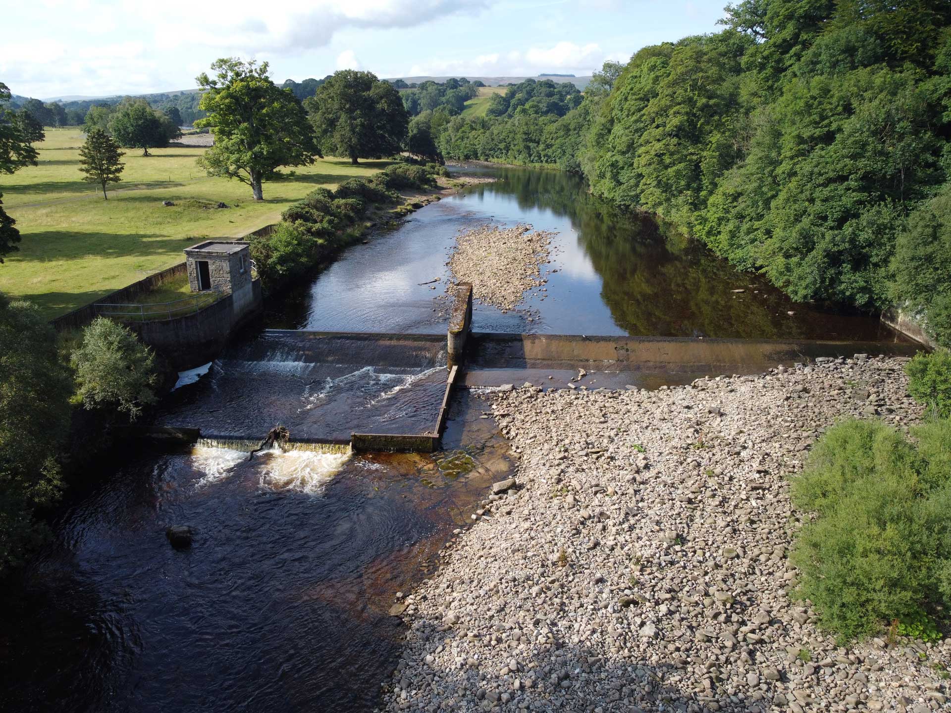
Gravel build-up around a gauging station weir can influence how accurately river flow is measured. Discover how we applied a 3D Computational Fluid Dynamics (CFD) model at Featherstone gauging station on the River South Tyne to assess its impact on the relationship between water level and flow.

Gravel had accumulated around the weir at Featherstone gauging station, raising concerns that it could affect how river flows are calculated from water level measurements. As the station plays an important role in flood forecasting, it was vital to understand whether these natural changes were affecting the results.
- Client: Environment Agency
- Location: River South Tyne, Northumberland
- Services
Assessing the impact of gravel deposition on gauging performance
Rather than removing the gravel, the Environment Agency wanted to know whether they could "learn to live with" these ongoing changes in the river channel by balancing the ecological benefits of the gravel deposits with the need for reliable flow monitoring.
Using drone survey data and in-channel measurements, we developed a 3D CFD model to test how existing, dredged and future channel conditions would affect the gauging station's rating curve.
The study found that the predicted rating curves for all tested channel conditions remained within approximately ±7% of the existing rating curve, demonstrating that the gravel deposits had only a limited effect on the gauging station's performance.
CFD modelling also indicated that, even if the channel were dredged, gravel would be likely to re-accumulate during relatively modest flow events, making repeated removal an unsustainable long-term solution.
Balancing ecological benefits with flood monitoring requirements
Our findings gave the Environment Agency confidence that natural channel changes could be accommodated without intervention while maintaining reliable flow measurements for flood forecasting and warning. This avoided unnecessary environmental disturbance to valuable river habitats and potential eel passage benefits associated with the gravel deposits.
The combination of drone surveying and CFD modelling also provided a safe and cost-effective alternative to repeated field surveys and high-flow gauging.

Services


At JBA we apply system-level, data-driven thinking to deliver practical solutions that improve asset health, enhance resilience and maximise long-term value for the people, businesses and communities assets serve.
 Find out more
Delivering transformative technology that is pioneering in the pursuit of flood, water and environmental resilience.
Find out more
Developing leading resilience strategies and solutions founded on the integrated modelling and assessment of water quantity, quality and environmental processes.
Find out more
Working within a robust and mature digital delivery environment, our engineering specialists work closely with our modelling, hydrology and environmental teams to ensure designs are developed to create efficient, low-carbon and sustainable solutions.
Find out more
Our specialists in landscape, heritage, ecology, fisheries, EIA, planning and sustainability all work collaboratively with our engineering designers, modellers and our project managers to develop resilient places.
Find out more
Our proven skills and experience make us a natural partner to help support communities and organisations to become more resilient. We support and empower our clients to manage the twin risks of flood and drought, encouraging and delivering effective water management.
Find out more
Working with communities across the world to identify and mitigate flood and environmental risks, support sustainable development and build resilience.
Find out more

