Computational Fluid Dynamics modelling at Featherstone gauging station
A 3D Computational Fluid Dynamics (CFD) model was used to assess the accuracy of a rating curve in predicting flow levels, given the presence of gravel build-up near the weir. Three scenarios were tested: existing gravel build-up in the channel, dredged and aggraded riverbeds. This cost-effective method minimised the time spent surveying the river.
- Client: Environment Agency
- Location: River South Tyne, Northumberland
- Services
Challenge
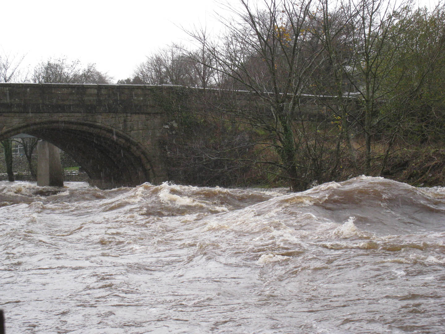
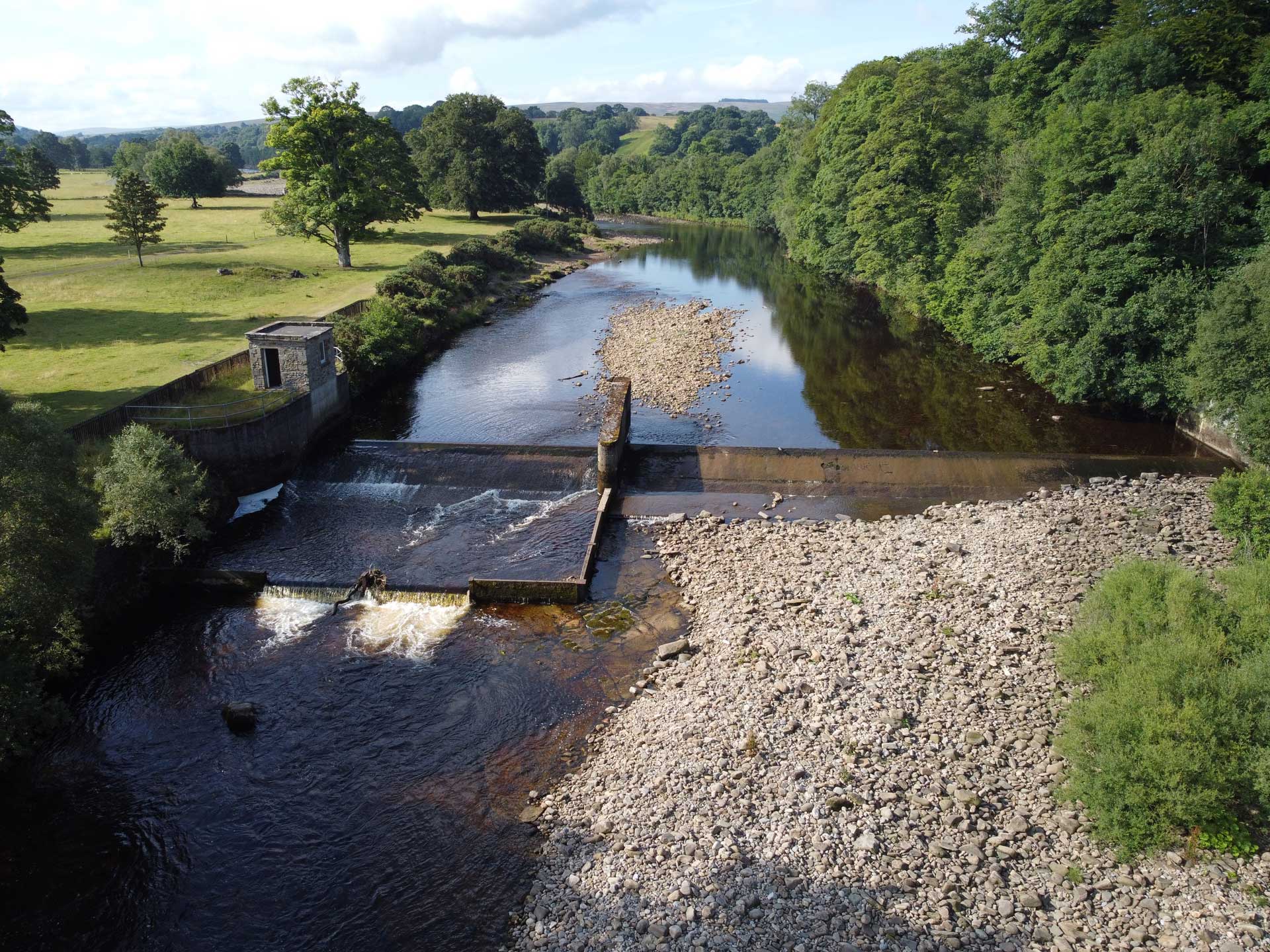
Featherstone gauging station on the River South Tyne is a two-stage weir with sloping faces and a central dividing pillar. There is gravel build-up in close proximity to the weir, and concern that the gravel is producing low confidence in the rating curve and inaccurately predicting flows.
Normally, under modular weir flow conditions, a theoretical rating curve for a weir structure that is calibrated with spot gaugings would provide a reliable stage-flow relationship. However, the gravel build-up at Featherstone means that confidence in the rating is low and potentially leads to inaccurate flow derivation for flood forecasting and warning downstream.
Solution
We used a drone survey of Featherstone reach, combined with in-channel GPS points, to produce a digital elevation model (DEM) of the river channel. We transferred the DEM survey data into a CFD model. This 3D model solves the full three-dimensional form of the Navier-Stokes flow equations with sophisticated turbulence modelling and a relatively fine grid, and with less dependence on user-defined parameters than in 1D or 2D models. We also built a 1D HEC-RAS model to generate boundary condition for the 3D model.
We then ran several steady-state models in the 3D CFD model, using a range of upstream flow rates to produce the rating curve for the existing gravel build up (baseline scenario). We also did this for dredged and aggraded riverbed scenarios, to give a comparison of the impacts on the rating curve.
Benefit
Our modelling work demonstrated that the impact of the gravel build-up on the rating is minimal. Our CFD modelling also showed that, should the channel be dredged, the gravel is likely to be re-deposited even at relatively modest flows. This confirmed that dredging and repeated removal of gravel is not a sustainable option. Removal of gravel also leads to significant environmental disturbance to in-situ wildlife and potential spawning sites, and there are also believed to be eel passage benefits associated with the gravel. We recommended continued monitoring of the bed evolution – with the use of the model to adapt the rating if necessary – rather than any intervention to remove the gravel.
A detailed CFD modelling study was a cost-effective solution. The drone survey minimised the time surveyors were in or close to the river, and the use of CFD modelling to check high flow ratings avoided the need for manual gauging at potentially dangerous flows.
Email Andy Collier for more information about the Featherstone gauging station project.
Services
Delivering transformative technology that is pioneering in the pursuit of flood, water and environmental resilience.
Developing leading resilience strategies and solutions founded on the integrated modelling and assessment of water quantity, quality and environmental processes.
Working within a robust and mature digital delivery environment, our engineering specialists work closely with our modelling, hydrology and environmental teams to ensure designs are developed to create efficient, low-carbon and sustainable solutions.
Our specialists in landscape, heritage, ecology, fisheries, EIA, planning and sustainability all work collaboratively with our engineering designers, modellers and our project managers to develop resilient places.
Our proven skills and experience make us a natural partner to help support communities and organisations to become more resilient. We support and empower our clients to manage the twin risks of flood and drought, encouraging and delivering effective water management.
Working with communities across the world to identify and mitigate flood and environmental risks, support sustainable development and build resilience.

