Groundwater tracer tests - Examining the effects of an abandoned mine
We investigated groundwater flow pathways within a former mining area of the Gwydir Forest in North Wales. Our investigation provided essential baseline data, a hydrogeological understanding of the groundwater system and an analysis of water quality.
- Client: Natural Resources Wales (NRW)
- Location: Gwydir Forest, North Wales
- Services
Challenge
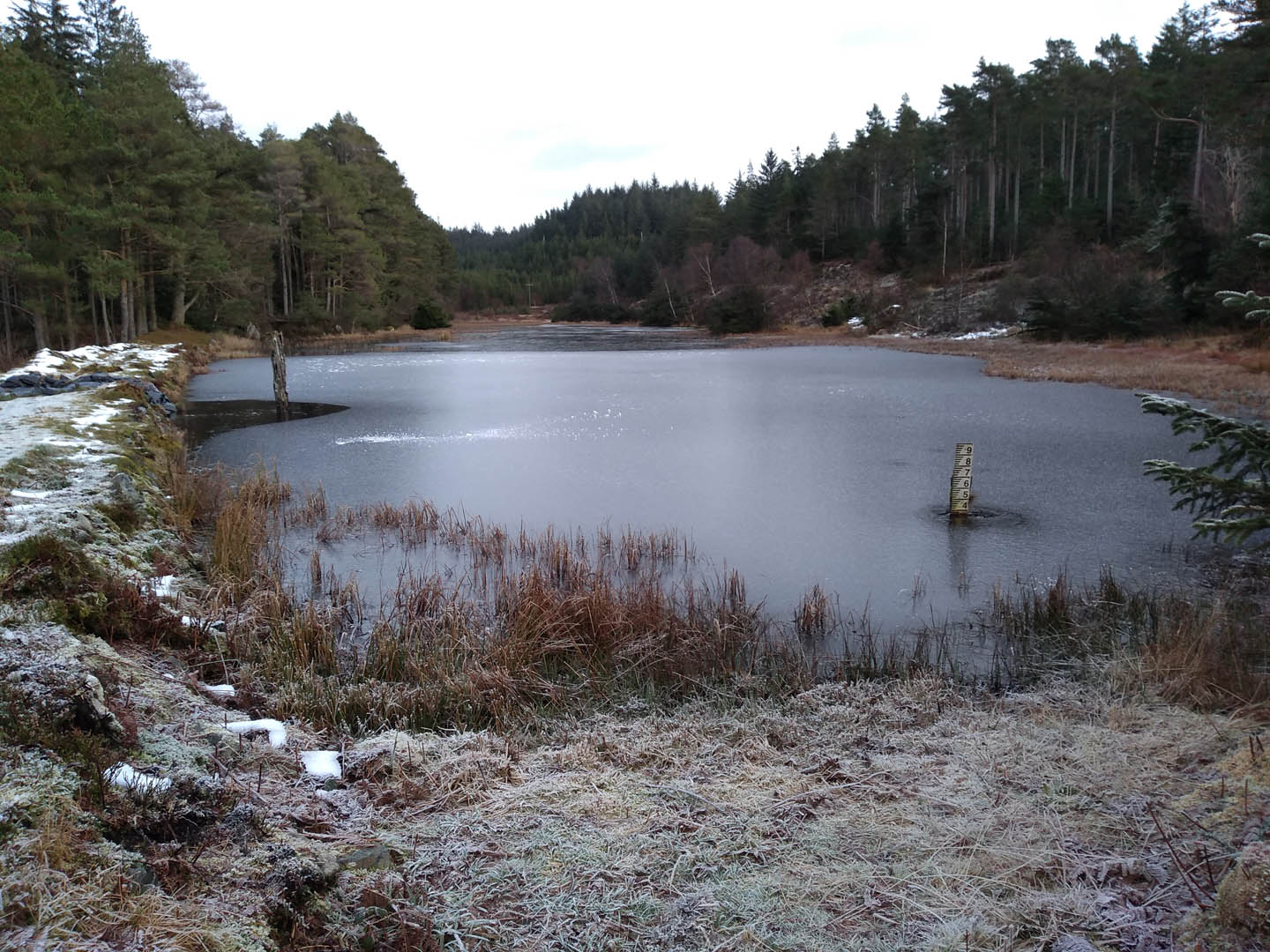
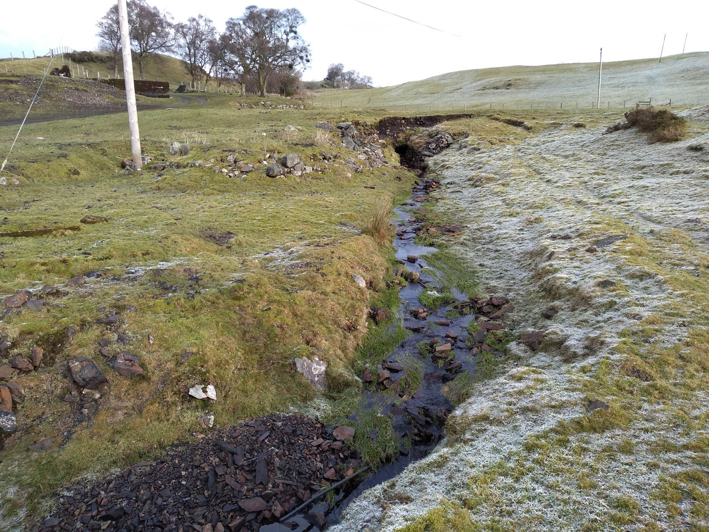
The Gwydir Forest Park was dominated by lead and zinc mining from the 1800s with the last mines closing as late as the 1960s. Each mine had its own water supply supported by local reservoirs, and Natural Resource Wales (NRW) is working to make both the mines and reservoirs safe for increased public access. At this site, there are two main reservoirs in addition to a private relic reservoir. The outflows from the reservoirs flow via streams across areas of historic mine spoil, which are both unstable and at risk from flood condition flows. Understanding the role of the mine workings on flow pathways was needed to help inform NRW’s decision-making for the optioneering of the reservoir outflows.
It is believed that stream flows could be lost into the relic underground mine system. Establishing whether water is lost to the mine system and if or where it then re-emerges further downstream will help inform NRW’s optioneering of the reservoir outflows.
Solution
To develop a semi-quantitative understanding of groundwater flow pathways, we completed an initial tracer test using salt (NaCl). As expected for a historical lead mine, values of sodium and chloride are relatively low, hence their suitability for use as a tracer. In comparison, iron, sulphate, lead and zinc concentrations are elevated within the water environment.
We selected injection and monitoring locations based on the current conceptual hydrogeological understanding of the site. We chose three monitoring locations within 1km of the injection site to track the advancement of the salt plume. Conductivity probes and data loggers were employed to measure electrical conductivity as a proxy for NaCl, therefore tracking the movement of the tracer. Conductivity values were converted to Total Dissolved Solid (TDS) concentrations and used to compile tracer breakthrough curves (concentration versus time) for each of the tracer tests.
Benefit
Results from the tracer testing indicated that 85% of the mass of the tracer was lost along the stream length, to the mine spoil or mine levels below. This indicates losing stream behaviour, which corroborates the flow monitoring data for the site. The stream losses are significant for the flow dynamics of the catchment.
Our study also provided key baseline information, hydrogeological understanding of the groundwater system and water quality analysis, on which NRW can expand their studies into surface water/aquifer interconnectivity in historic mining areas.
Contact Michael McDonald for more information about this project. Click here for more information about our work in this area.
Services
At JBA we apply system-level, data-driven thinking to deliver practical solutions that improve asset health, enhance resilience and maximise long-term value for the people, businesses and communities assets serve.
Delivering transformative technology that is pioneering in the pursuit of flood, water and environmental resilience.
Developing leading resilience strategies and solutions founded on the integrated modelling and assessment of water quantity, quality and environmental processes.
Working within a robust and mature digital delivery environment, our engineering specialists work closely with our modelling, hydrology and environmental teams to ensure designs are developed to create efficient, low-carbon and sustainable solutions.
Our specialists in landscape, heritage, ecology, fisheries, EIA, planning and sustainability all work collaboratively with our engineering designers, modellers and our project managers to develop resilient places.
Our proven skills and experience make us a natural partner to help support communities and organisations to become more resilient. We support and empower our clients to manage the twin risks of flood and drought, encouraging and delivering effective water management.
Working with communities across the world to identify and mitigate flood and environmental risks, support sustainable development and build resilience.

