Grand Union Canal modelling and hydrometric survey
A multidisciplinary project combining the expertise of our modelling and surveying teams to determine the feasibility of plans to secure sustainable sources of water.
This multi-phased and ongoing project is being developed collaboratively with Affinity Water, Severn Trent Water and the Canal and River Trust.
- Client Affinity Water, Severn Trent Water, Canal and River Trust
- Location Grand Union Canal
- Services
Providing modelling and surveying expertise to assist in addressing the long-term challenges of procuring resilient, sustainable sources of water
In the face of climate change, population growth and the need to reduce unsustainable abstractions, water companies in England and Wales are exploring a range of Strategic Resource Options (SROs) to secure sustainable sources of potable water.
One such option under consideration by Affinity Water, Severn Trent Water and the Canal and River trust is to use the Grand Union Canal to transfer treated effluent from Birmingham to the central supply area, which forms a ring around the west and north of London. However, any proposed route would need to factor in the challenges posed by multiple summits, around 100 locks and inter-connections with sensitive rivers.
To explore the feasibility of this SRO we were appointed to this collaborative project through the Affinity Water Professional and Technical Services framework, to undertake hydrological, hydraulic and water quality modelling of the transfer.
In conjunction with our modelling services, we were also tasked with conducting hydrometric and topographic surveys of the canal and connected watercourses in order to verify and improve a water resources and hydraulic model of the suggested transfer route between Birmingham and Hertford/Bedfordshire.
We developed a tool to transfer Aquator flow results to Flood Modeller Pro inflows, enabling us to run several iterations of the proposed Grand Union Canal scheme.
Modelling present-day and future scenarios
Utilising existing models created by the Canal and River Trust as a starting point, our modelling teams created a single model to represent the proposed scheme route. This allowed us to incorporate sources of flow into the canal and identify inflows from gravity and pumped feeders into the canal network, as well as water losses and movement due to lock operations, leakage and evaporation. As a result, we were able to model present-day and future scenarios over long time periods to assess the potential impacts of periods of both flood and drought.
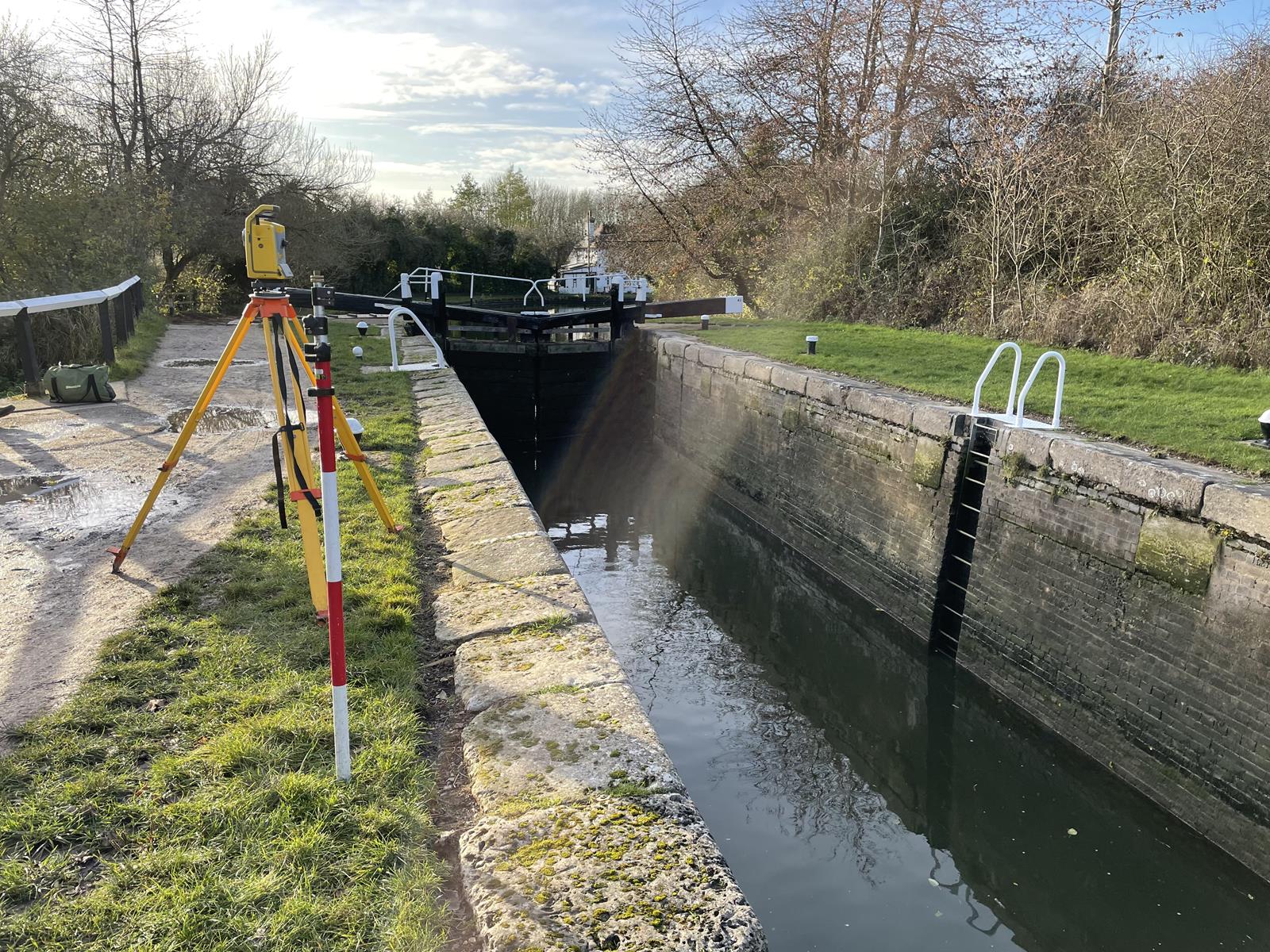
Embracing state-of-the-art surveying methods
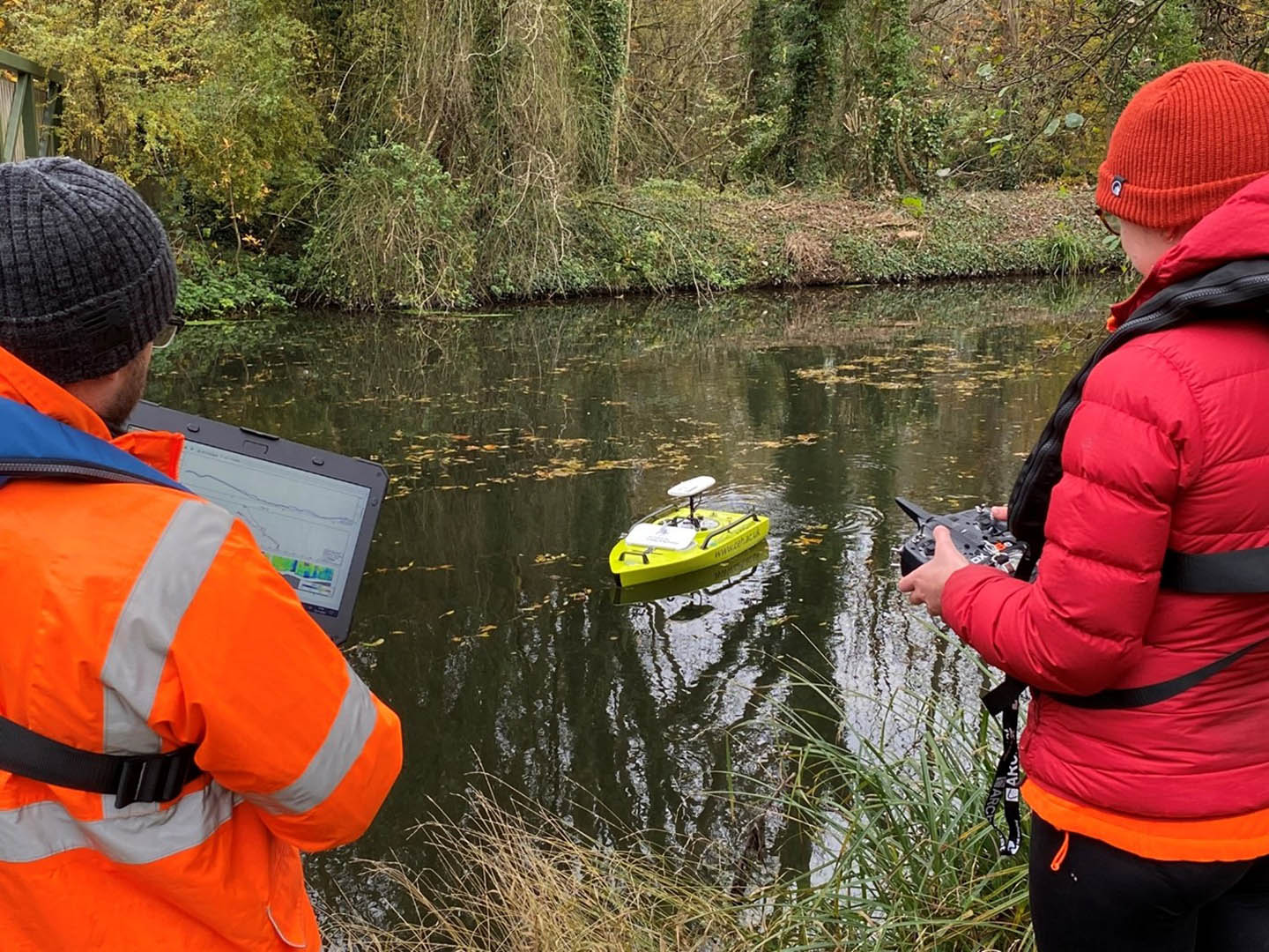
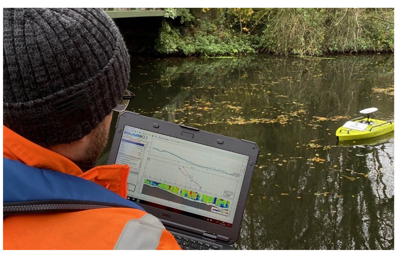
Understanding the relationship between the canal level and spillway weirs required spot flow measurements at several canal feeders and spills. This presented an opportunity for our survey teams to embrace a new technology in place of traditional hand-held spot gauging. By instead using the River Surveyor M9 Acoustic Doppler Current Profiler (ADCP) our surveyors were able to provide flow measurements with greater accuracy and efficiency. This approach also gave our teams access to depth and flow data in real time, eliminated the need to access third party land and increased the number of sites that could be gauged.
Services
At JBA we apply system-level, data-driven thinking to deliver practical solutions that improve asset health, enhance resilience and maximise long-term value for the people, businesses and communities assets serve.
Delivering transformative technology that is pioneering in the pursuit of flood, water and environmental resilience.
Developing leading resilience strategies and solutions founded on the integrated modelling and assessment of water quantity, quality and environmental processes.
Working within a robust and mature digital delivery environment, our engineering specialists work closely with our modelling, hydrology and environmental teams to ensure designs are developed to create efficient, low-carbon and sustainable solutions.
Our specialists in landscape, heritage, ecology, fisheries, EIA, planning and sustainability all work collaboratively with our engineering designers, modellers and our project managers to develop resilient places.
Our proven skills and experience make us a natural partner to help support communities and organisations to become more resilient. We support and empower our clients to manage the twin risks of flood and drought, encouraging and delivering effective water management.
Working with communities across the world to identify and mitigate flood and environmental risks, support sustainable development and build resilience.

