Land Use and Coverage Area frame Survey (LUCAS)
A multiple lot project requiring close collaboration between our software and surveying service teams, supported by the development and utilisation of innovative JBA software, GISmapp®.
In late 2021 we were successful in being appointed to two lots of the Land Use and Coverage Area frame Survey, having previously supported the triennial campaign in 2012, 2015 and 2018.
- Client Eurostat
- Location UK and Ireland
- Services
An innovative data collection and storage solution with JBA-developed software at its core
The Land Use and Coverage Area frame Survey (LUCAS) takes place every three years and aims to identify land use and land coverage change in the EU. Consisting of multiple lots, the triennial LUCAS campaigns have seen us provide a variety of software and surveying services since 2012.
As well as collecting information on land use and coverage, these surveys also gather data and photographs on everything from water management to erosion at more than 400,000 survey points across Europe. As a result, the data generated through LUCAS surveys has become a key tool for policymakers and statisticians alike. Providing access to comparable statistics on land use and land cover across the whole of the EU’s territory – a total area of just under 4.5 million square kilometres (km²).
Hosting and Support
A major element of each LUCAS campaign is hosting and supporting the centralised, cloud-based software and through this lot we designed and built the required IT infrastructure to host the software and upload the data collected. Through continual improvements and innovations, we were able to increase the efficiency of the software and streamline the process of data entry.
Ireland Survey
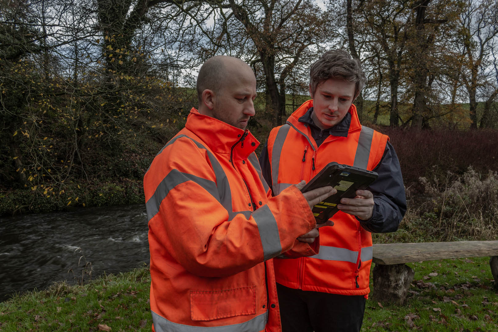
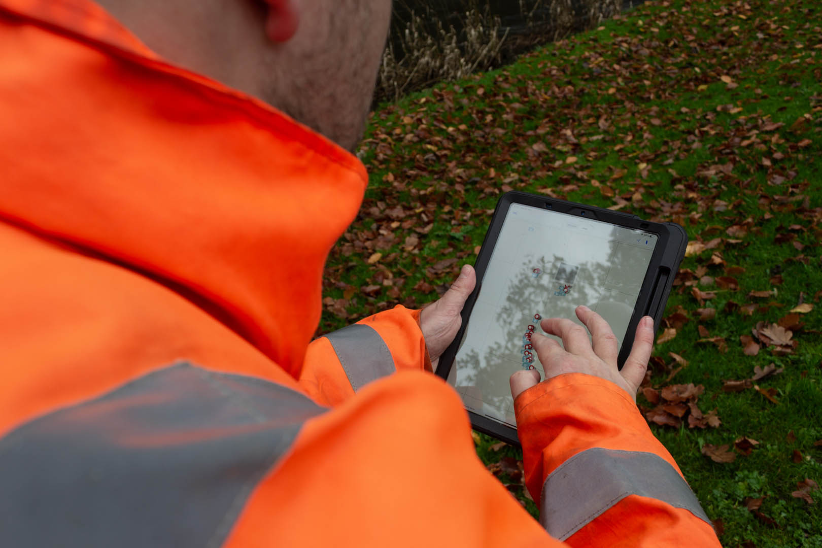
This lot required close collaboration between our software and survey teams to conduct in-situ surveys for over 4,000 LUCAS points across Ireland. Faced with the task of assessing the land cover and land use at these points, this presented an ideal opportunity to make use of GISmapp® an iOS site data collection tool developed by our software team. By using GISmapp® and integrating it with Eurostat’s Application Programmers Interface (API) we were not only able to quickly generate data collection forms, but also send data directly to the ventral LUCAS database.
Innovative mobile asset data management solutions
GISmapp® was originally developed as a location-aware mapping system used to collect asset data, guide asset inspections and manage health and safety risks during site visits. Through continued investment and research and development its applications have become much more widespread, making it ideal for everything from coastal structural asset surveys to projects such as LUCAS surveys. Due to its customisable interface and functionality GISmapp® allows the user to define the type of data that will be captured and also provides a series of dynamic forms, making the process of collecting data much more efficient. By automatically geo-locating point, polyline or polygon assets and photographs this data can also be viewed in a mapping environment. To further streamline the survey process, adding and editing data through GISmapp® doesn't require network access, this is instead automatically synchronised when a connection is available. This software was key to the success of our LUCAS project work and remains an essential tool for a range of services and teams throughout JBA.
Services
At JBA we apply system-level, data-driven thinking to deliver practical solutions that improve asset health, enhance resilience and maximise long-term value for the people, businesses and communities assets serve.
Delivering transformative technology that is pioneering in the pursuit of flood, water and environmental resilience.
Developing leading resilience strategies and solutions founded on the integrated modelling and assessment of water quantity, quality and environmental processes.
Working within a robust and mature digital delivery environment, our engineering specialists work closely with our modelling, hydrology and environmental teams to ensure designs are developed to create efficient, low-carbon and sustainable solutions.
Our specialists in landscape, heritage, ecology, fisheries, EIA, planning and sustainability all work collaboratively with our engineering designers, modellers and our project managers to develop resilient places.
Our proven skills and experience make us a natural partner to help support communities and organisations to become more resilient. We support and empower our clients to manage the twin risks of flood and drought, encouraging and delivering effective water management.
Working with communities across the world to identify and mitigate flood and environmental risks, support sustainable development and build resilience.

