
JBAi: Shaping a resilient future through AI innovation
We’ve been exploring and harnessing the potential of artificial intelligence (AI) for over 12 years. Two years ago, we formalised that journey with the launch of JBAi – our dedicated AI accelerator programme. Since then, AI has become embedded across all our specialisms, helping us to deliver work that’s faster, smarter, and more efficient for us and our clients.
How is AI shaping our work?
From flood forecasting and environmental modelling to infrastructure resilience and data analysis, AI is now a core part of how we innovate.
We also recognise that innovation is a journey - and although AI enhances our capabilities, it’s our people who continue to drive our projects forward. We remain committed to using AI ethically and responsibly, ensuring it complements our expertise rather than replaces it.
Artificial intelligence and machine learning have many facets. We use a range of AI and machine learning technologies that can be grouped into categories: Predictors, Communicators, Image Segmentors, Optimisers, Emulators and Pattern Discovery.
You can explore some of our latest applications here, including projects that harness AI to support decision-making, automate complex processes, and unlock new insights.
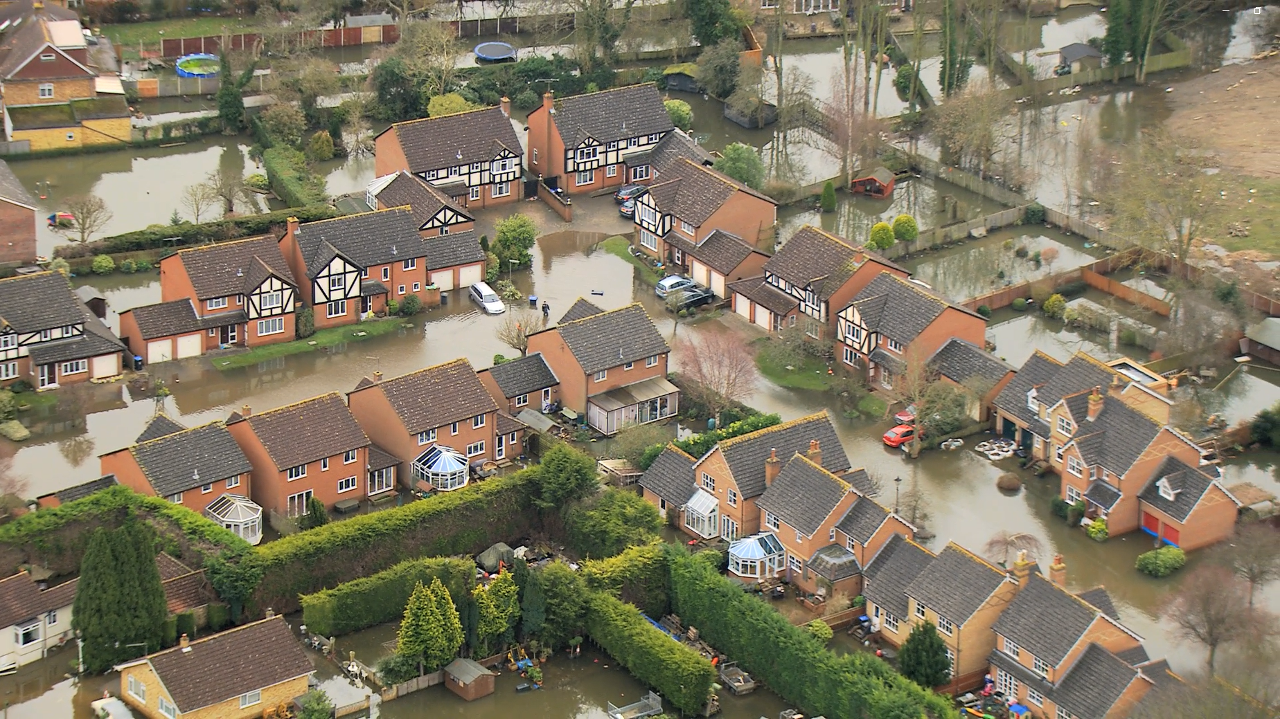
Advanced AI predictor technology to generate real-time flood warnings for Eastbourne
Eastbourne faces a complex flood risk, with tidal surges, river floods, and surface water all interacting. There is a detailed Integrated Catchment Model (ICM) of the town, but it is too slow for real-time use, taking 16 days to simulate just 24 hours. We are now using Convolutional Neural Networks (CNNs) to emulate the ICM, delivering fast, accurate flood forecasts in seconds.
This makes it possible to issue postcode-level flood warnings based on real-time rainfall forecasts - including probabilistic information to reflect uncertainty. As part of the Flood and Coastal Resilience Innovation Programme (FCRIP), this work will bring powerful, life-saving information directly to local communities when it matters most.
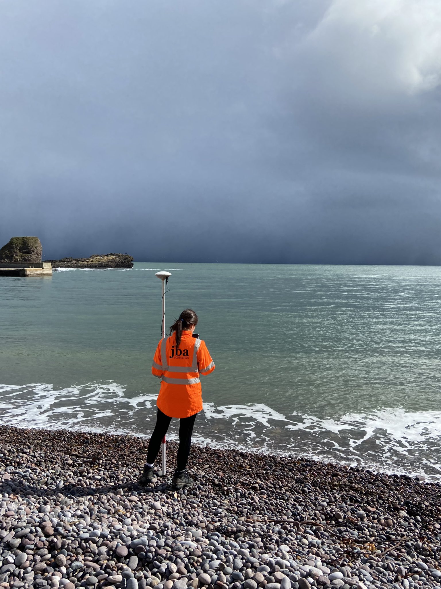
Harnessing AI to power image segmentation for coastline monitoring
The Coastsnap AI project applied advanced artificial intelligence techniques to extract meaningful data from community-sourced beach photographs. Using a U-Net convolutional neural network for image segmentation, the team trained a model to automatically identify and delineate the Stonehaven seawall from a set of photos.
This approach transformed qualitative community science data into semi-quantitative information, producing time series of seawall exposure that can inform understanding of beach evolution and the risk of overtopping during storm events.
AI was essential to this project because manual analysis of hundreds of community photos would be slow and inconsistent, and programmatic methods would struggle with the complexity of coastal features. By applying AI, the project demonstrated a scalable, near-real-time monitoring method that not only benefits local communities but also shows wider potential for coastal risk management and infrastructure protection.
Climate and flood resilience planning boosted by AI optimisers
Resilience Studio® is a JBA-developed digital platform that helps users understand, plan for, and manage risks associated with flooding, climate change and other environmental challenges. It allows decision makers and stakeholders to experiment with a variety of mitigation and investment measures over time, to visually evaluate the impact, cost and benefit across catchments and coastlines. Examining risk mitigation options like nature-based solutions or hard engineering and balancing them against each other over a multi-decadal timescale.
Resilience Studio® includes an AI tool to optimise the investment strategy. Based on a user-defined target, such as a cost-benefit ratio, the tool can propose an optimised combination of resilience measures to invest in over time, presented as an investment pathway to 2100.

Transforming asset management through pattern discovery machine learning
JBA’s Spectral Analysis Tool, JSAT®, is a new technology providing early warning of changes to land cover, enabling our clients to take mitigating and anticipatory action. JSAT® is transforming the way water companies monitor, identify and manage pollution risks to groundwater drinking sources. Harnessing machine learning and satellite imagery, it enables rapid detection of land surface changes for proactive asset management.
Developed in partnership with Affinity Water and supported by JBA Labs, the system uses a series of proprietary innovations to detect changes in land use through a machine learning-enabled analysis of satellite images.

For more information contact our Al Innovation Lead, Zoe Smith.

