Preliminary Historic Environment Appraisal Report for the Medway Estuary and Swale Coastal Realignment Scheme
We recently completed a Preliminary Historic Environment Appraisal Report (PHEAR) for a coastal realignment scheme for the Elmley and South Sheppey Outline Business Case (OBC). This work for the Environment Agency forms part of the Medway Estuary and Swale Flood and Coastal Erosion Risk Management Strategy (MEASS), which includes a series of schemes designed to improve protection for homes and businesses and to provide compensatory habitat.
PHEAR: Establishing the heritage baseline
A PHEAR is the equivalent of a desk-based assessment to map all of the heritage in the scheme area, compliant under the minimal technical requirements of the Environment Agency. The PHEAR aims to provide a comprehensive baseline assessment of known heritage assets, including those in the maritime environment, and the potential for previously unrecorded archaeological remains. This means any impacts as a result of climate change can be assessed. We were appointed by the Environment Agency to complete the PHEAR to assess potential heritage impacts and propose mitigation measures.
- Client Environment Agency
- Location Isle of Sheppey
- Services Environment and Sustainability
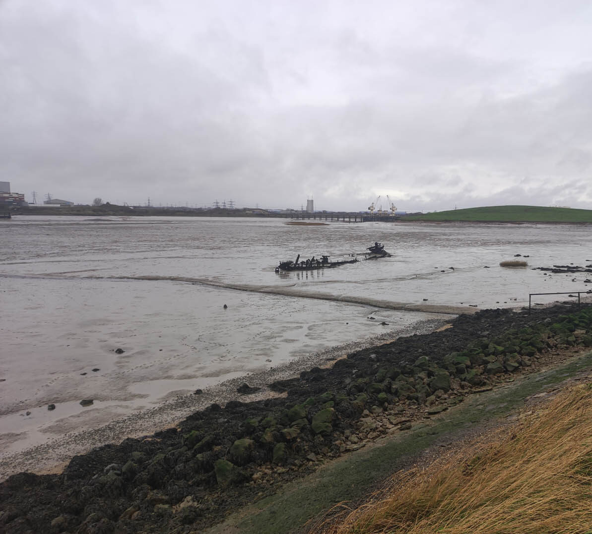
South Sheppey coastal realignment scheme
The proposed coastal realignment scheme is situated along the coast in the South Sheppey area of the Isle of Sheppey. The scheme incorporates two managed realignment areas located within the Elmley National Nature Reserve and at Spitend Point. A study area was established in a 100m buffer around the proposed scheme.

Evidence of early human activity and archaeological record
Evidence of prehistoric activity is known from sites on the Isle of Sheppey, most notably at Sheppey and Kingsborough, but these seem concentrated on higher areas of land inland rather than at the coast. There is very limited known archaeological evidence within the study area relating to the prehistoric period. Only the Neolithic is represented by a few isolated findspots, the Bronze Age by an uncertain record of a Bronze Age bowl barrow and the Iron Age by a single midden.
During the Roman period, the area began to be exploited for salt, with evidence of saltworking coming from multiple sites in the study area. There is no clear evidence from the Historic Environment Record (HER) for settlement activity alongside the industrial activity, but it is possible that settlement sites could exist, though these are more likely to be located on areas of higher land.
The medieval period is better represented in the study area compared to earlier periods. Many of these records also relate to salt mounds or saltworkings, primarily located to the rear of the currently existing sea defences.
The current surviving sea-defences have their origins in post-medieval periods, with a Rapid Coastal Zone Assessment identifying surviving elements of the sea-embankment. Seaward of the embankments, various wooden features are recorded in the intertidal area including rows of stakes, fish traps, jetties and wharfs, with potential for these features to extend into the development boundary.
Heritage impacts and proposed mitigation measures
The PHEAR recommended that assets identified as located within the managed realignment areas should be investigated to ascertain their level of survival and gain a more detailed understanding of the degree of preservation. Further investigation, such as a geophysical survey or archaeological excavation and recording, may also be required, and if so, these can then be designed.
It also identified that, depending on the scale and extent of the required hold-the-line works, there may be impacts on former sea defences with heritage significance and heritage assets located on or close to the hold-the-line area. This will need to be reviewed when more design information is available, allowing appropriate mitigation to be recommended.
The construction of new access routes and compound areas could also impact heritage assets. Once construction information is available, a further review of the potential impacts will be made. Also, if materials are to be brought in by the coast, then a review of potential impacts on wrecks with heritage significance will also be undertaken.
The result of any required mitigation in the form of further walkover surveys, geophysical surveys, archaeological excavation and recording would provide an opportunity to further understand the historic environment in this area and contribute towards objectives within the South East Research Framework.
Contact our Heritage team for more information.

