Project Groundwater: What we’ve learned about groundwater flooding and Nature-based Solutions
As Project Groundwater comes to an end, one of the clearest lessons from the Nature-based Solutions workstream is that understanding how groundwater reaches and moves through the landscape is just as important as understanding where it emerges. We’ve investigated how restoring natural processes can help build catchment resilience in groundwater-dominated catchments in the Chiltern Hills and Berkshire Downs. Read on to discover what we’ve learned.

What is groundwater flooding?
Groundwater flooding, as defined by the British Geological Survey (BGS), is:
"The emergence of groundwater at the ground surface away from perennial river channels or the rising of groundwater into man-made ground, under conditions where the 'normal' ranges of groundwater level and groundwater flow are exceeded."
It also notes that exceptionally large flows from perennial springs, or large flows from intermittent or dormant springs, can cause both localised flooding near the springs and down-gradient where surface water drainage channels may not be adequate.
In practice, there are generally two key aspects to groundwater flooding:
- Groundwater emergence when rising groundwater levels reach the surface, and
- An overwhelmed surface drainage network which is not able to convey the emerging groundwater.
What is Project Groundwater?
Delivered by Buckinghamshire Council, this six-year programme partnered with communities in nine high-risk groundwater flood areas across the Chiltern Hills and Berkshire Downs. Through targeted community engagement, the programme increased awareness and understanding of groundwater flooding, enhanced local monitoring, and improved flood warning systems. In this article, we share the valuable insights gained over the last four years working on this Flood and Coastal Resilience Innovation Programme project, funded by Defra and the Environment Agency.
Understanding the gap between mapped risk and true flooding
Our JBA Groundwater Flood Map, like other groundwater flood mapping products, identifies areas where groundwater may emerge at the surface. However, taking the next step to assess whether, or to what extent, surface water drainage networks may become overwhelmed by groundwater emergence is a more complex technical challenge.
This means it can be difficult to predict the number of properties which will actually flood in a groundwater event. In many cases, existing surface water drainage infrastructure can accommodate groundwater emergence without resulting in flooding. Peak flows associated with surface water or river flooding are typically much greater than groundwater emergence rates and may occur at different times. As a result, features such as drainage ditches across floodplains or swales within housing developments can often continue to function effectively, even when groundwater levels are elevated.
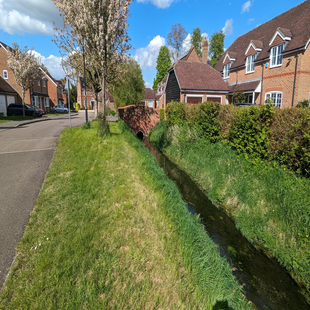

Rivers in the 'wrong' places
Across the UK, rivers have been extensively modified over centuries, with many channels diverted from their natural courses. Across the Project Groundwater catchments, we repeatedly identified a clear link between groundwater flooding and locations where rivers had been historically realigned.
These modifications were undertaken for a variety of reasons, from creating larger agricultural fields on valley floors to accommodating railway construction. However, some of the most severe groundwater flooding occurred where rivers had been diverted high along valley sides to create weirs and to supply water to historic mills. In these cases, the river no longer occupied the lowest part of the valley, reducing its ability to intercept and drain groundwater that would previously have discharged directly into the channel.
The consequences of these alterations often remain hidden for decades or even centuries. In many settlements that expanded after the Second World War, the extent of river modifications carried out during the Industrial Revolution was no longer widely recognised. Across the Rivers Chess, Misbourne and Colne, we found multiple examples where the legacy of historic weirs and millraces was a primary underlying cause of groundwater flooding, illustrating how past changes to surface water networks can continue to shape flood risk today.


The forgotten winterbournes
A winterbourne is a distinctive feature of chalk-dominated landscapes. It is an intermittent stream that usually flows during winter and spring, fed primarily by rising groundwater levels within chalk aquifers. As groundwater levels decline, flows typically cease during the drier summer months. Winterbournes are widespread across many chalk catchments.
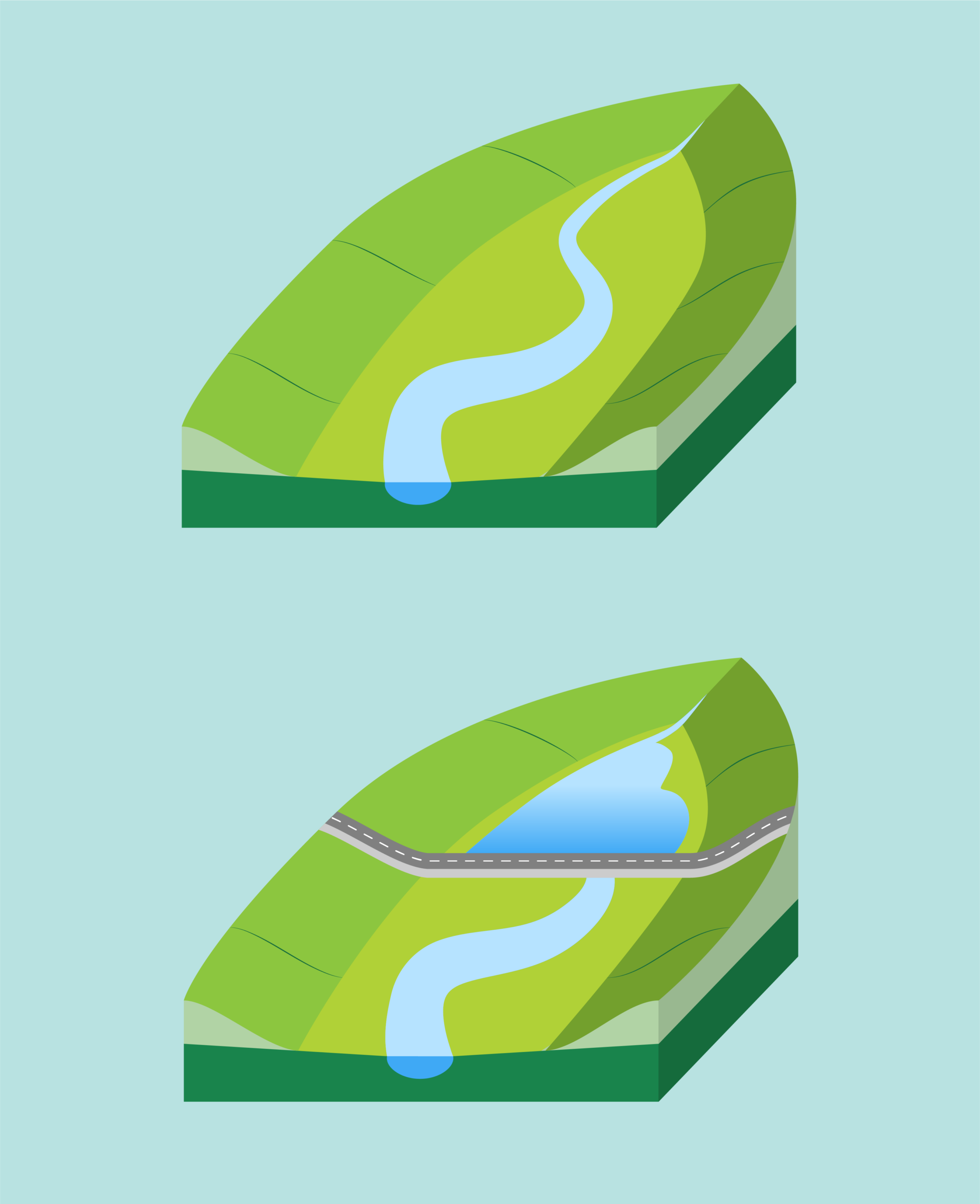
Where winterbournes flow regularly, watercourses are generally well maintained. However, the upper reaches of winterbournes that flow only infrequently, perhaps once a decade or less, can become overlooked within the landscape. A common theme that was observed during our work in these areas was that the natural channel had often been significantly altered or obscured. Examples of this included the construction of tracks or roads across the channel, or historic watercourse routes being ploughed in through arable fields.
How can nature-based Solutions help?
The answer to alleviate the impact of groundwater flooding in chalk-dominated catchments can be surprisingly straightforward on paper: restore natural processes and return watercourses to their natural locations. This could mean re-establishing forgotten or lost winterbournes in the headwaters, or realigning rivers further down the catchment to their original courses along the valley bottoms. Our trial to re-establish the winterbourne in the Upper Pang between East Ilsley and Compton, which is due to begin construction in the autumn, provides a clear template for this approach.
In certain situations, renaturalisation of flow pathways will not always be possible. In many cases, whole towns have been built over historic watercourses, and channels cannot simply be moved. However, by understanding how the natural drainage system has been modified and why it cannot always convey additional flows during groundwater flood events, we can identify other potential solutions to alleviate groundwater flood risk.