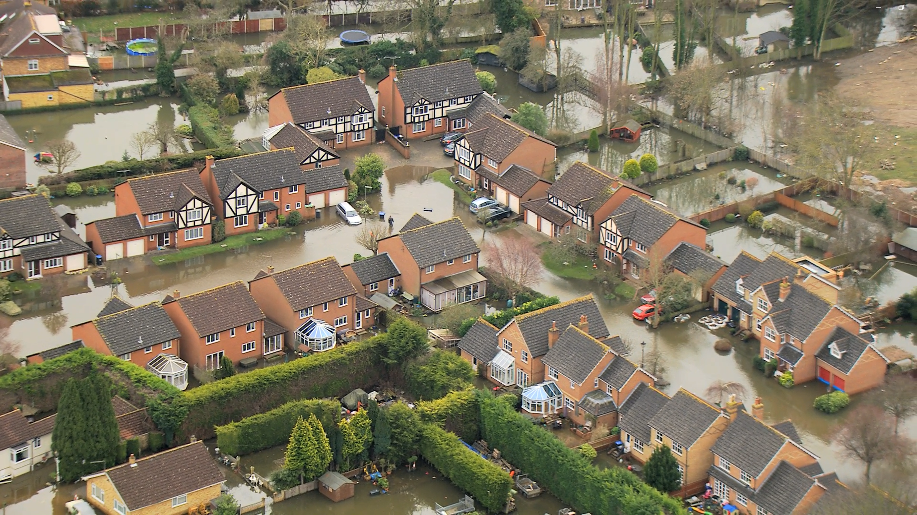
The Environment Agency's updated Flood Map for Planning will incorporate the latest data from the new National Flood Risk Assessment (NaFRA2), providing a single picture of current and future flood risk from rivers, the sea and surface water for England. This update will also include the latest national coastal erosion mapping to account for the impacts of sea level rise.
Having worked collaboratively with the Environment Agency, Jacobs and other consultant partners on the design, development and implementation of NaFRA2, we are well-placed to understand the implications and advise our clients on how to use the data available. However, before we explore the benefits of NaFRA2 and the role we believe it will play in simplifying Strategic Flood Risk Assessments (SFRAs), let’s first look at how SFRA flood risk data is currently collected and used.
How is SFRA flood risk data currently collected and used?
SFRA flood risk data is collated from multiple sources, often with inconsistencies or ambiguities requiring our own ‘knitting together’ of old and new datasets to produce SFRA mapping. For example, climate change mapping for fluvial and tidal flood risk has only been available to date where detailed hydraulic modelling exists. There has been no climate change mapping for surface water.
Furthermore, not all detailed modelling received is of the same quality. Unless a hydraulic model has been recently updated to reflect the latest technical guidance, it is unlikely that all models received for an SFRA will be comparable. Data quality, age and level of accuracy can differ significantly, for example comparing a recent 1D-2D model (which provides detailed depth, velocity, hazard and latest climate change outputs) versus an older 1D-only model (which provides basic interpolated flood extents, using outdated ground level and hydrology data).

As a result, for each SFRA we have to undertake a scoping exercise and agree on a climate change modelling or proxy approach with the local planning authority and Environment Agency. This exercise results in significant additional cost and time for local planning authorities, with differing approaches agreed across the country, and often by the time Local Plan Examinations are reached, some data or guidance has been superseded.
What are the benefits of NaFRA2? And will it help simplify SFRAs?
What we do know, as one of the two contributing consultants who really understand the data, is there will be greater consistency, accuracy, coverage and precision with the data in NaFRA2.
There will be more published information in one place than ever before. For example, modelled Flood Zones, climate change scenarios, representation of small watercourses, fluvial and surface water mapping in the ‘same space’, and mapping of the 30-year (3.3% AEP) flood event (previously not available), which will help local authorities identify the functional floodplain in SFRAs. This is an exciting step-change. For the first time, present-day surface water flood risk is also going to be included in the Flood Map for Planning alongside flooding from rivers and sea. The addition of climate change mapping for these sources of risk should also mean SFRAs will not need to use proxies (for example using Flood Zone 2 as a proxy for Flood Zone 3 with climate change), removing the potential for climate change flood risk to be either over or under-estimated. This, in turn, will allow more accurate and consistent assessments of flood risk and development for local plan allocations.
A vast improvement that we have had a significant input to, are new quality assessments produced for recently completed models and is available for all local modelling used in NaFRA2 processing. As part of this, checks are made to identify models that meet a ‘minimum criteria’. This will prove extremely useful in making the SFRA data analysis more efficient and clearer with regard to using the best possible data. No doubt, in some cases we will still need to request data which has been input into NaFRA2 for further analysis, but NaFRA2 will greatly simplify SFRA data collection in the future and ensure more consistency between national datasets and model scenarios that were previously required to run.
In addition to flood risk, the new National Coastal Erosion Risk Mapping also presents a significant improvement on past datasets. It shows climate change scenarios for the first time and provides more reliable erosion projections using an additional 10 years of data from the regional coastal monitoring programme. This dataset is particularly useful for coastal SFRAs and in defining Coastal Change Management Areas for Local Planning Authorities.
What are our hopes for the future?
By Summer 2026, all final NaFRA2 data inputs and fixes should be complete; this will include surface water climate change and retained areas where the latest data is yet to be presented due to residual uncertainties. We hope that this will also include data showing what modelling has been used where.
We look forward to seeing updated SFRA guidance on .GOV.uk and hope that changes to the Flood Map for Planning will be reflected within the anticipated revision to the Planning Practice Guidance. This should lead to a more consistent approach to the Sequential Test in the longer term.
We hope that practical support will be provided by the Environment Agency to local authorities that have made significant progress in their Local Plan process or are about to enter examination. SFRAs do need to be easily updated as ‘live’ documents, but it can take a long time to reach examination and, therefore, at some point they have to form a ‘snapshot in time’. Support from the Environment Agency will likely be case-specific, and a risk-based approach will be applied with regard to the severity of change in mapping and the associated scale of development.
In this intervening ‘transition phase’, there are perhaps several ‘practical’ data-related questions we can all relate to, which we hope will be ironed out. For SFRAs, these include how to obtain depth, velocity and hazard data from models that Level 2 SFRAs need and are not currently available on the NaFRA2 portal, how to represent climate change for surface water and the approach to retained areas until these are infilled. However, at JBA we are solution-finders. These short-term challenges and bumps in the road during the transition phase can certainly be worked through, and we are very well-placed with our experience, information and contacts to help bridge the gaps and tailor responses to different local planning authorities’ needs.
Overall, we believe this new data will help SFRAs become more agile. It will help change the focus of effort that goes into producing an SFRA, for example reducing data collection and collation efforts to thinking more about the policy recommendations that NaFRA2 can enable. This in turn will help planners and developers achieve confident and more consistent decision-making, in pursuing appropriate development in areas at the lowest flood risk.
There are really exciting times ahead. We are on the cusp of something great and we look forward to working through it with you. Our involvement in NaFRA2 means we are confident that the medium and long-term benefits will positively outweigh the few short-term challenges, leading to a bright future where the production of SFRAs is streamlined and consistent between local planning authorities, which we’re sure will be welcome news.
For more information on the implications of NaFRA2 and how we can support you to make the most of the data available, pleased contact Joanne Chillingworth or Ed Hartwell.

