
Working in partnership with the Scottish Environment Protection Agency (SEPA) to support Scotland's resilience to flood risk, both now and in the future
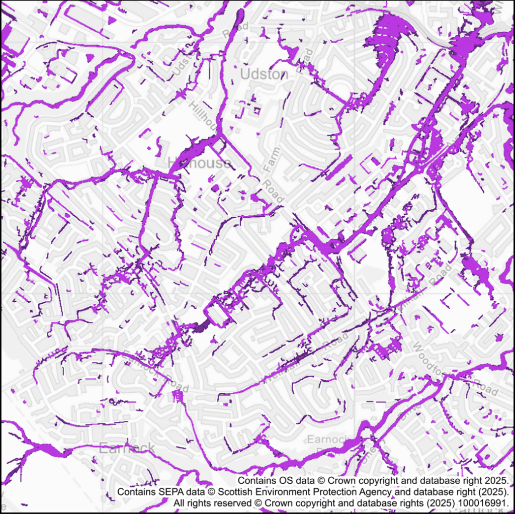
In collaboration with SEPA, we have developed new surface water and small watercourse flood maps, providing Scotland with the most detailed and accurate picture yet of flood risk from these sources. These maps mark a major step forward in helping communities, businesses, and local authorities understand and prepare for surface water flooding, which remains Scotland’s biggest flood risk.
Advancing Flood Risk Management with SEPA’s new maps
Key highlights of the new Surface Water and Small Watercourses Flood Maps
- Comprehensive coverage: The new flood maps cover nearly 80,000km2 of Scotland.
- Enhanced detail: The maps offer a nationally consistent approach with a 2-metre spatial resolution, providing the best available detail and accuracy.
- Efficient modelling: Utilising JBA Consulting’s JFlow® hydraulic modelling software, the project completed over 85,000 flood risk simulations incorporating the latest rainfall estimates and climate projections.
- Stakeholder engagement: Collaborative engagement with local authorities and national partners ensured the integration of feedback and additional evidence data, enhancing the accuracy and reliability of the maps.
Supporting SEPA’s Flood Risk Management Role
Since 2021 SEPA and JBA Consulting have worked in collaboration to develop new surface water flood hazard mapping across Scotland using JFlow® to provide a consistent high-resolution map across 80,000km2 of Scotland. Surface water flooding impacts both urban and rural communities and climate change is set to increase the hazard significantly. The new flood maps incorporate the latest science and data, to predict current and future surface water flood hazard.
The new flood maps provide a major advancement in supporting SEPA’s flood risk management role and the implementation of the Scottish National Adaptation Plan 2024-2029. These maps are crucial for supporting SEPA’s wider flood risk management activities, including helping communities, businesses, and local authorities understand, plan, prepare and respond to surface water flooding.
For more information, contact David Bassett or Iain Craigen.

