Integrated flood and coastal modelling to develop flood risk resilience in Panama City
A flood risk and coastal assessment of the Tocumen catchment to assess the potential of hybrid infrastructure and nature based solutions (NBS) for urban flood risk reduction.
Using an integrated hydraulic model of coastal, fluvial and pluvial flood sources, supported by a new analysis of sea-level rise, rainfall intensity and land use, we were able to model three alternative future scenarios for development in the Tocumen catchment, east of Panama City.
- Client The World Bank
- Location Panama City, Panama
- Wider Team Municipality of Panama City
- Services
Modelling alternative, resilient futures for development in a rapidly urbanising catchment
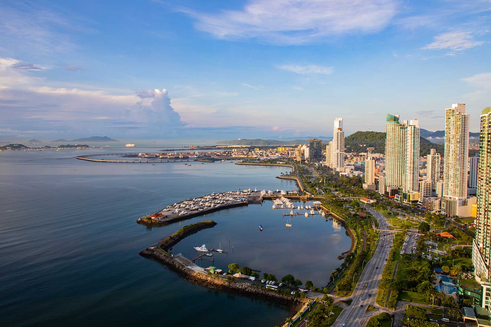
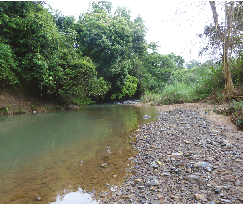
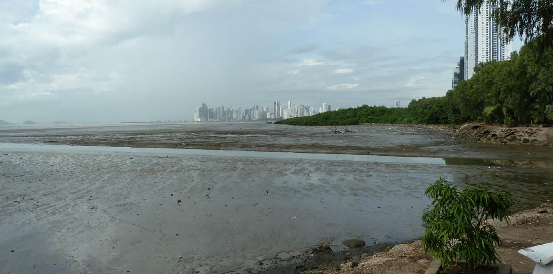
The catchment of the River Tocumen has undergone rapid urbanisation in recent decades. This has resulted in a loss and degradation of natural habitats including deforestation in the steep upper catchment, urbanisation in the fluvial floodplains and most recently a rapid loss of mangroves due to land-filling and raising for coastal property developments. This has contributed to an increase in flood risk from fluvial, pluvial and coastal sources, with eight deaths and c. 13,000 people impacted by recent floods.
Spatial planning policies and laws have not kept up with the city's transition to a regional and international hub, with a lack of adequate zoning, building control and drainage contributing to the flood risk. Flood risk was predicted to increase significantly, including at the international airport, due to land use, climate change and sea-level rise.
Identifying nature-based solutions to mitigate climate risk
In parallel with our integrated hydraulic modelling, the evolution of the river and coastal systems over recent decades was analysed. This identified opportunities for mangrove regeneration to provide a valuable service protecting the coastline from erosion. The study also showed that in urban areas mangroves are exhibiting signs of stress, meaning they don't provide the level of flood protection offered by a healthy system.
Three future scenarios for the development of the city were developed. The scenario based on the restoration of natural floodplain and mangrove systems demonstrated that nature-based solutions have the potential to mitigate the impacts of climate change.
Supporting sustainable development
The study made recommendations for all sectors involved in or able to influence flood risk management. Opportunities were identified in two currently undeveloped floodplain areas to both optimise their topography to store and reduce flood peaks, and to provide space for recreation and high-quality development zoned on higher ground.
Through our investigation, we enhanced the Municipality’s evidence base to support its emerging district plan. Capacity building training was delivered to a wide range of stakeholders and was used to develop a training session at the 2020 Understanding Risk CentroAmérica (URCA 2020) conference.
Click here to download the World Bank report for this project.
Services
Delivering transformative technology that is pioneering in the pursuit of flood, water and environmental resilience.
Developing leading resilience strategies and solutions founded on the integrated modelling and assessment of water quantity, quality and environmental processes.
Working within a robust and mature digital delivery environment, our engineering specialists work closely with our modelling, hydrology and environmental teams to ensure designs are developed to create efficient, low-carbon and sustainable solutions.
Our specialists in landscape, heritage, ecology, fisheries, EIA, planning and sustainability all work collaboratively with our engineering designers, modellers and our project managers to develop resilient places.
Our proven skills and experience make us a natural partner to help support communities and organisations to become more resilient. We support and empower our clients to manage the twin risks of flood and drought, encouraging and delivering effective water management.
Working with communities across the world to identify and mitigate flood and environmental risks, support sustainable development and build resilience.

