Professional placement
For the last few months, as part of a professional placement module in my final year at university, I have been lucky enough to spend one day per week working from the JBA Coleshill office as part of the Flood Foresight team.
The overall aim of the validation project I was tasked with was to investigate and determine the extent to which the Flood Foresight software effectively predicts the scale of flood events.
New skills
By comparing its outputs to other satellite imagery sources. Although I had no previous experience in using the software and resources required for this project – Q-GIS and Sentinel satellite imagery – thanks to input from the Flood Foresight team, I picked up the required skills fairly quickly and was able to produce maps like the one below.
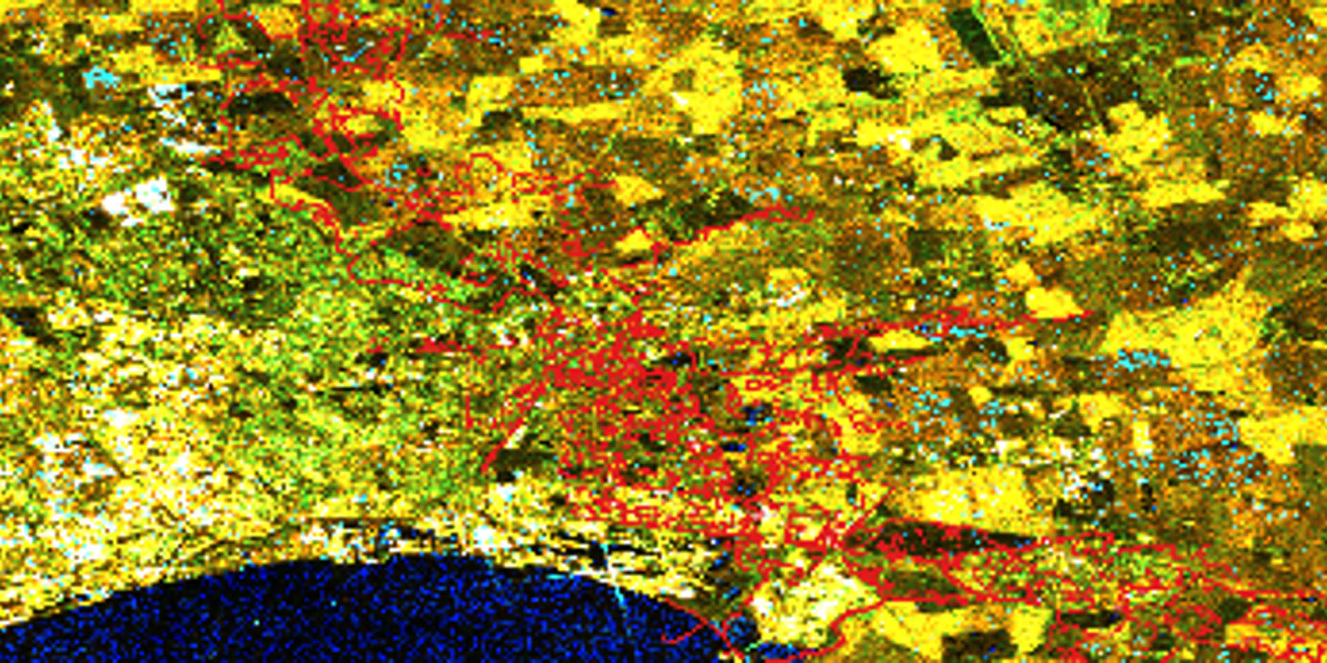
QGIS mapping
I produced this map in QGIS using satellite imagery over one of the chosen case study locations: Sutton, Hull for 22nd January 2021. The image shows a comparison of Flood Foresight predictions (red) and satellite imagery from Sentinel Hub (light blue). Comparing and mapping this, in conjunction with many other images, then enabled me to understand the prediction capabilities of Flood Foresight in relation to observed flood extents.
A 'virtual' experience
In the final week I remotely delivered a presentation to the Flood Foresight team with an overview of my experience and reflections on the conclusions I had arrived at. By working on this project I have developed professional and technical skills, such as working as part of a large team and using the new mapping software. I have also gained experience of working in an office environment for the first time – something which I enjoyed and looked forward to each week.
This has been a very rewarding experience and has made me interested in pursuing a career in the consultancy sector. Despite only meeting the majority of the team virtually, they were all very welcoming and friendly. I’d like to thank them all for their help.
You can find out more about professional placement opportunities with JBA on our careers page.
Services
Delivering transformative technology that is pioneering in the pursuit of flood, water and environmental resilience.
Developing leading resilience strategies and solutions founded on the integrated modelling and assessment of water quantity, quality and environmental processes.
Working within a robust and mature digital delivery environment, our engineering specialists work closely with our modelling, hydrology and environmental teams to ensure designs are developed to create efficient, low-carbon and sustainable solutions.
Our specialists in landscape, heritage, ecology, fisheries, EIA, planning and sustainability all work collaboratively with our engineering designers, modellers and our project managers to develop resilient places.
Our proven skills and experience make us a natural partner to help support communities and organisations to become more resilient. We support and empower our clients to manage the twin risks of flood and drought, encouraging and delivering effective water management.
Working with communities across the world to identify and mitigate flood and environmental risks, support sustainable development and build resilience.

